After three days of 35-37°C heat, at least seven provinces, including Quang Ninh, Bac Ninh, Hung Yen, Phu Tho, Ninh Binh, Thai Nguyen, and Hanoi, were hit by thunderstorms and lightning from 1:30 pm to 5:00 pm today. The storms lasted for one to two hours, and Quang Ninh also experienced hail.
The National Center for Hydro-Meteorological Forecasting reported wind speeds of 16 m/s (level 7) at Cua Ong station (Quang Ninh), gusts of 26 m/s (level 10) at Bai Chay (Quang Ninh), and gusts of 18 m/s (level 8) at Bach Long Vi (Hai Phong).
At this time, Typhoon Wipha was located over 1,000 km east of Ha Long Bay. Its circulation extended 200-300 km from its center, with maximum sustained winds of 102 km/h (level 10) and gusts reaching level 12.
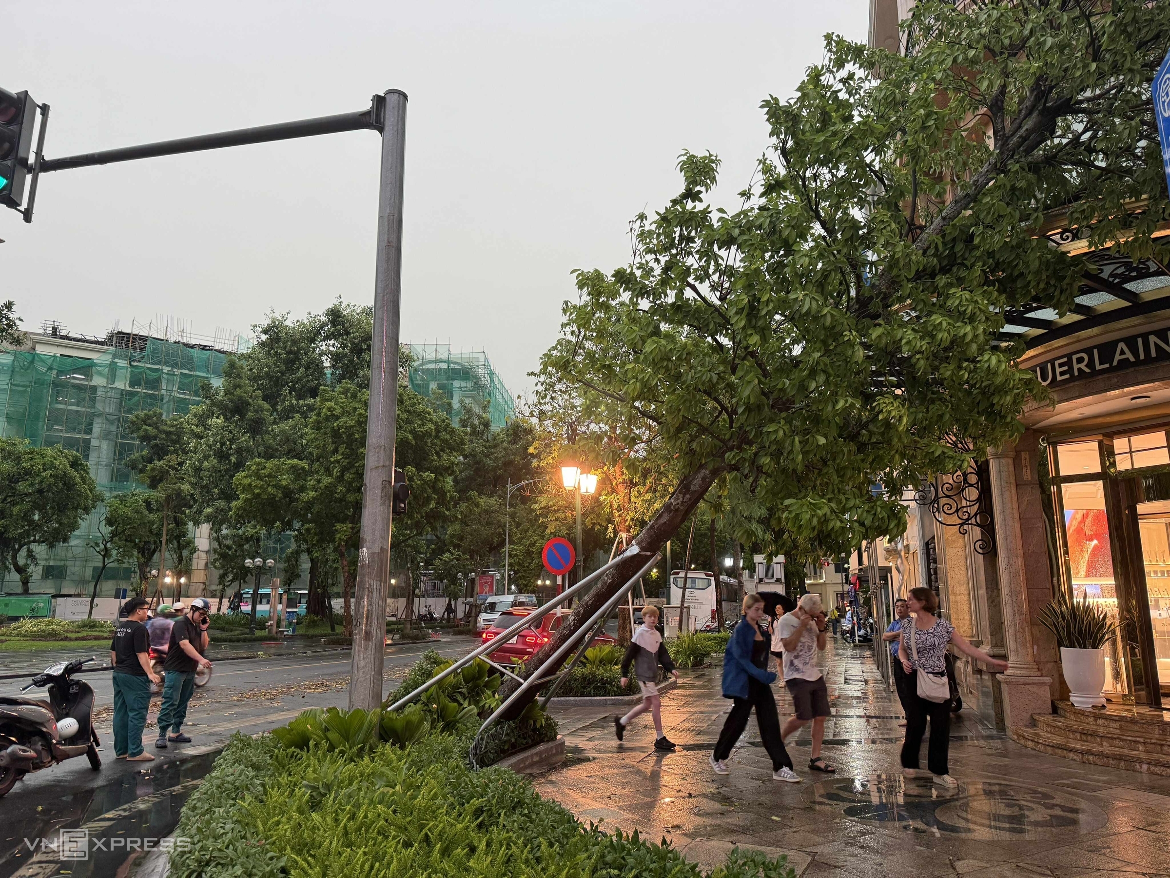 |
Fallen tree on a Hanoi street, afternoon of 19/7. Photo: Giang Huy |
Fallen tree on a Hanoi street, afternoon of 19/7. Photo: Giang Huy
Mai Van Khiem, Director of the National Center for Hydro-Meteorological Forecasting, stated that Typhoon Wipha was not yet affecting northern Vietnam or the Gulf of Tonkin. The intense thunderstorms this afternoon were caused by a combination of the Intertropical Convergence Zone passing through northern Vietnam and high temperatures in the region.
This caused strong updrafts to develop in unstable atmospheric conditions, triggering powerful thunderstorms. These are known as mesoscale convective systems (MCSs). "These large-scale thunderstorm complexes often bring torrential rain accompanied by dangerous weather phenomena and are rare," Khiem said.
Khiem explained that MCSs range from a few kilometers to several hundred kilometers in diameter and consist of multiple thunderstorm clusters combined into a larger system. They can last for many hours, even 12-24 hours, and are more powerful and longer-lasting than single thunderstorms.
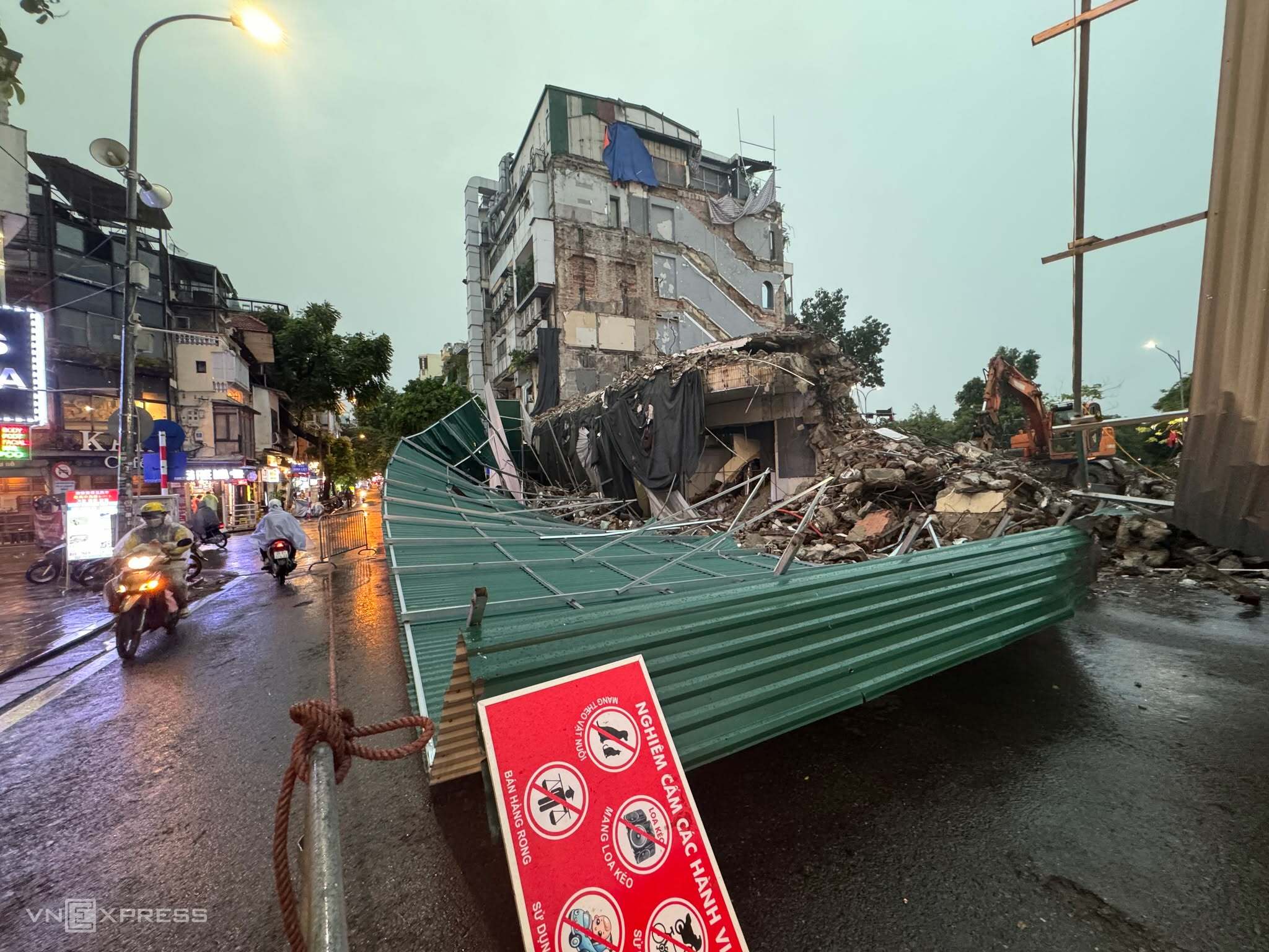 |
A fence surrounding the "Shark Jaw" building in Hanoi, a structure currently being demolished, collapsed on the afternoon of 19/7. Photo: Giang Huy |
A fence surrounding the "Shark Jaw" building in Hanoi, a structure currently being demolished, collapsed on the afternoon of 19/7. Photo: Giang Huy
To warn about the supercell thunderstorms, at 11:45 am, the Quang Ninh Hydro-Meteorological Observatory issued a warning for thunderstorms, tornadoes, lightning, hail, and localized heavy rain. The warning stated that at 11:45 am, convective clouds were developing, causing showers and thunderstorms in the following areas: Mong Cai wards 1, 2, and 3, and Vinh Thuc.
The warning also predicted that the thunderstorms would likely spread to the following areas: Quang Ha, Duong Hoa, Quang Duc, Hai Son, Hai Ninh, Dam Ha, Cai Chien, Hoanh Mo, Luc Hon, Binh Lieu, Dien Xa, Tien Yen, Dong Ngu, Hai Lang, Quang Tan, Hai Hoa communes, and neighboring areas.
In addition, the National Center for Hydro-Meteorological Forecasting issued two warnings for thunderstorms and tornadoes. The first warning was for all of northern Vietnam at 2:30 pm, and the second was specifically for Hanoi at 4:10 pm.
"During thunderstorms, be aware of lightning, tornadoes, strong gusts of wind, and landslides, which can cause trees and houses to collapse, damage transportation systems and infrastructure, and endanger human lives," the warning stated.
According to Mai Van Khiem, there will be no rain in Quang Ninh tonight, with northwest winds at levels 3-4; near dawn, there is a possibility of showers and thunderstorms, with visibility reduced to 4-10 km in the rain. Tomorrow morning, there will be no rain in Ha Long, with light winds; from noon and afternoon, there is a possibility of showers, thunderstorms, and waves of 1-1.5 m.
The storms caused a tourist boat carrying 48 tourists and five crew members touring Ha Long Bay to capsize at 1:30 pm. As of 9:00 pm, authorities have found 11 survivors and 34 bodies, with eight people still missing. Many localities have also reported damage, which the Department of Dyke Management and Natural Disaster Prevention is currently assessing.
Gia Chinh