The collapse occurred after noon on 12/8, causing a 30-meter long, 8-meter wide section of the road, sidewalk, and railing to cave in. The collapse extended 1.5 meters into the asphalt road, and further cracks appeared in the remaining asphalt.
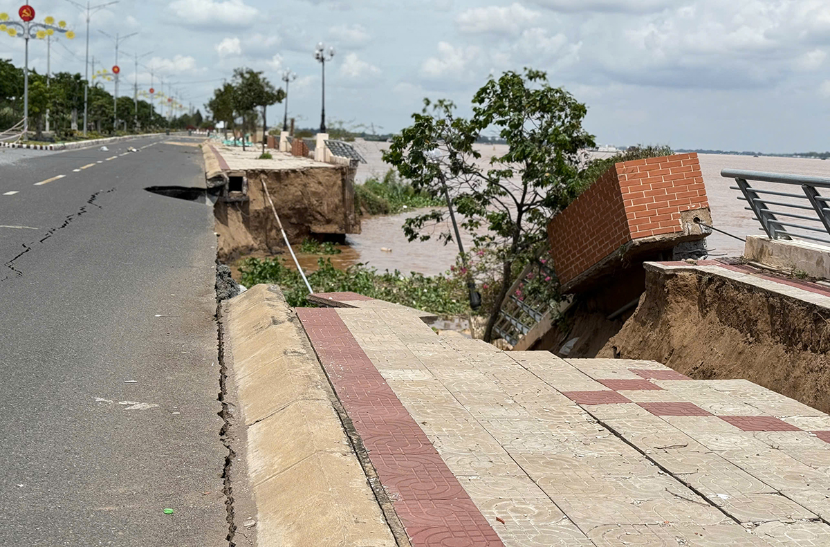 |
The collapsed section of the riverbank on the afternoon of 12/8. Photo: Nguyen Khanh |
Immediately following the incident, the Thuong Phuoc Commune Steering Committee for Climate Change Response, Disaster Prevention, Search and Rescue cordoned off the area, installed warning lights, and closed the road to ensure public safety.
Authorities noted that the rising floodwaters and strong currents increase the risk of further collapse. The affected area, opposite a fruit processing factory, could experience further erosion, threatening production and transportation.
The Thuong Thoi Tien embankment is part of the Mekong River Basin Wide Drought and Flood Risk Management Project, spanning over 4,000 meters and costing hundreds of billions of Vietnamese dong. The project, divided into two phases, was completed in late 2019.
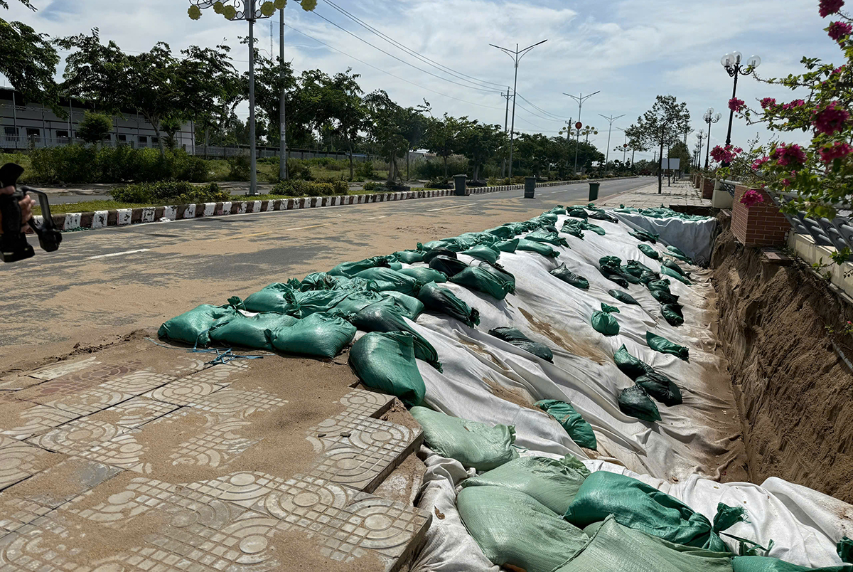 |
The section of the riverbank that collapsed on 7/8 has been temporarily reinforced. Photo: Nguyen Khanh |
Previously, on the afternoon of 7/8, approximately 40 meters of the same embankment collapsed, completely destroying the embankment and slope. The sidewalk, 28 meters long and 5 meters wide, also caved in, creating a large hole that extended deep into the road and caused cracks where the sidewalk meets the road.
Following that incident, the Dong Thap Department of Agriculture and Environment collaborated with the Southern Institute of Water Resources Science, the People's Committee of Thuong Phuoc Commune (UBND), and related units to temporarily reinforce the area with sandbags on a geotextile base. The Southern Institute of Water Resources Science has been asked to expedite surveying, assessment, and propose a solution.
Ngoc Tai