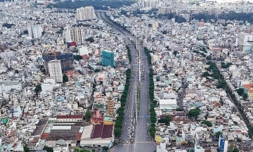
The Hanoi People's Committee is currently soliciting feedback for 20 days on the revised general master plan for the Red River urban subdivision, at a 1:5,000 scale. This plan aims to implement the Red River scenic boulevard investment project. The project's scope covers a 40 km stretch from Hong Ha Bridge to Me So Bridge, divided into three segments with distinct functions for development management. Each segment's planning and architectural criteria allocate 25% for thematic parks and 5% for public parks.
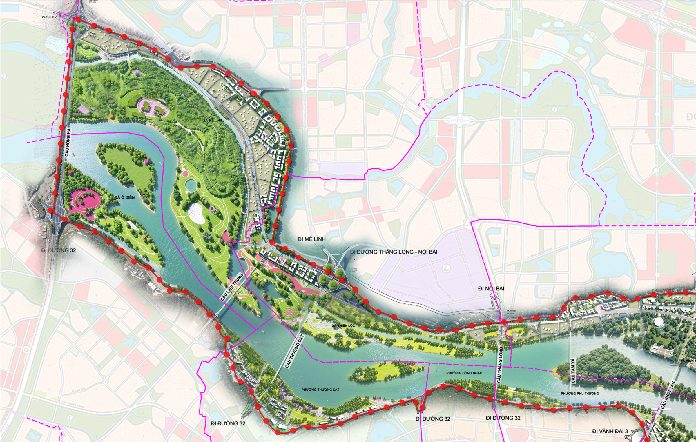 |
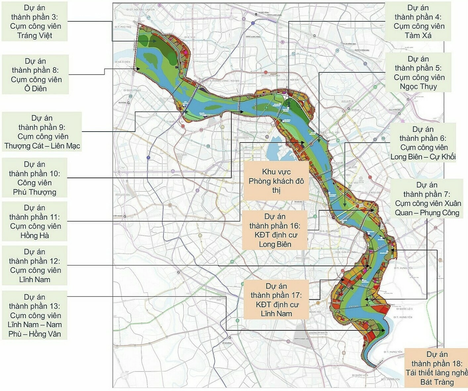
11 park clusters are arranged along the Red River scenic boulevard. Source: Hanoi Institute for Urban-Rural Planning.
The city envisions the Red River's banks as a distinctive green corridor, featuring waterways, historical culture, and a dominant landscape for the central urban area. The plan also aims to establish special flood discharge zones, integrating solutions for climate change adaptation and natural disasters. This ensures the safety of the flood discharge system and natural drainage, fitting the unique characteristics of the riverbank landscape.
The Hanoi Institute for Urban-Rural Planning, the unit developing the plan, highlighted two of nine principles for overall spatial organization: forming a chain of urban parks along the riverbanks and connecting them to the urban area via East-West green axes. Nature conservation parks will be located in frequently flooded areas outside the dyke.
The plan is materialized through 18 component projects, with 11 of them dedicated to park development. The park clusters arranged along the scenic boulevard axis include Trang Viet, O Dien, Thuong Cat - Lien Mac, Phu Thuong, Hong Ha, Linh Nam, Linh Nam - Nam Phu - Hong Van, Tam Xa, Ngoc Thuy, Long Bien - Cu Khoi, and Xuan Quan - Phung Cong.
 |
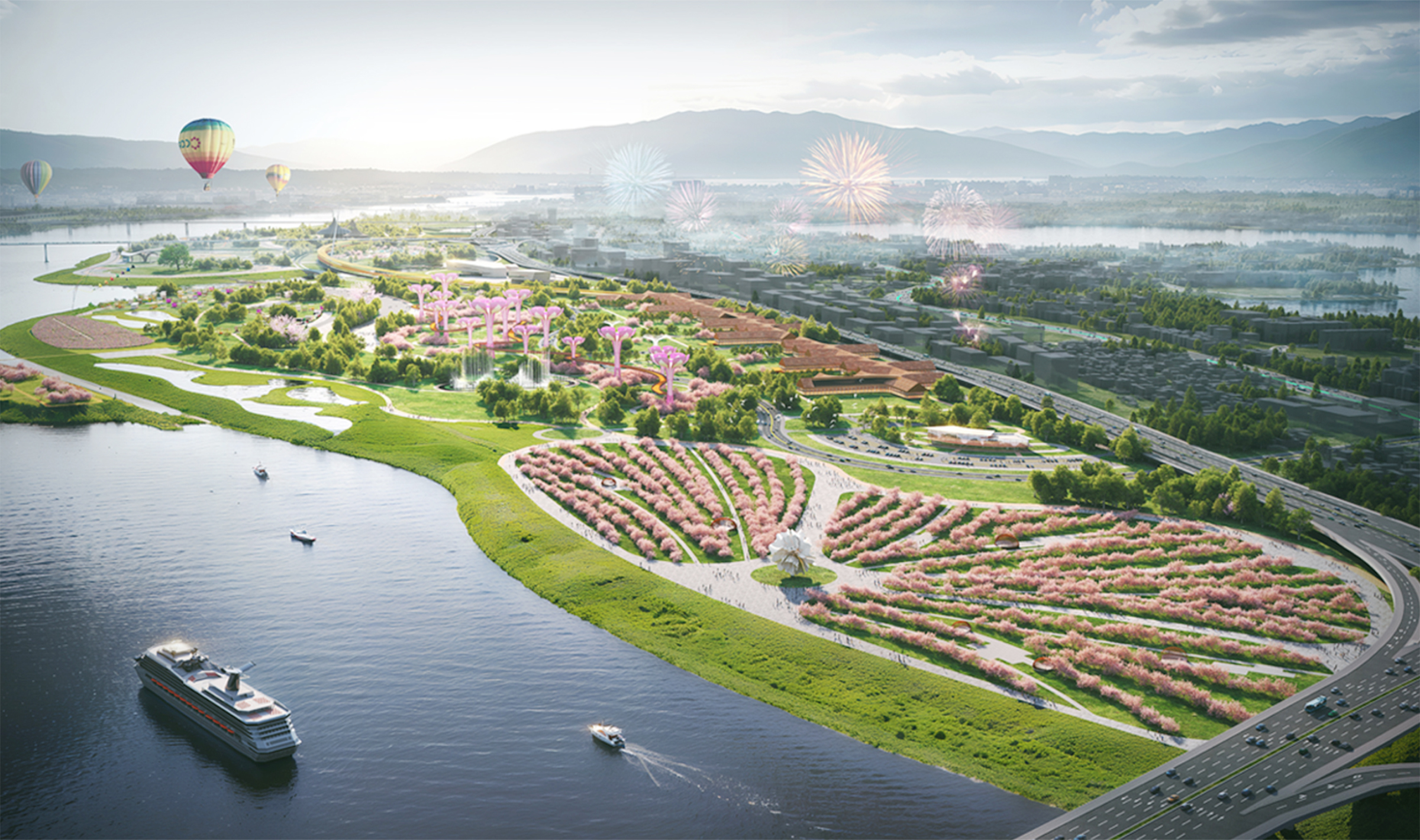
Perspective of the park cluster on the Red River's middle sandbar. Source: Hanoi Institute for Urban-Rural Planning
The overall master plan outlines the implementation schedule for component projects from 2026 to 2038. During the 2026-2030 phase, Hanoi will invest in two public park projects in Phu Thuong Ward and Hong Ha Ward riverbank park. This will occur concurrently with the development of the scenic boulevard along both river sides, riverbank revetment and channel rectification, the "urban living room" areas, urban resettlement zones in Linh Nam and Long Bien Wards, and an independent site clearance project. The remaining component projects are slated for completion during the 2030-2038 phase.
The plan organizes ecological urban spaces, living areas, public spaces, and parks according to architectural forms adapted to flood alarm levels, specifically elevation. Construction above 11,5 m is designated for conventional buildings. Elevations between 9,5 m and 11,5 m are allocated for adaptive, flood-tolerant structures such as floating houses and stilt houses, intended for recreational park spaces and community activities. From 7,5 m to 9,5 m, priority is given to road construction and semi-submerged riverbank parks. Elevations below 7,5 m are reserved for pedestrian paths and submerged park types.
 |
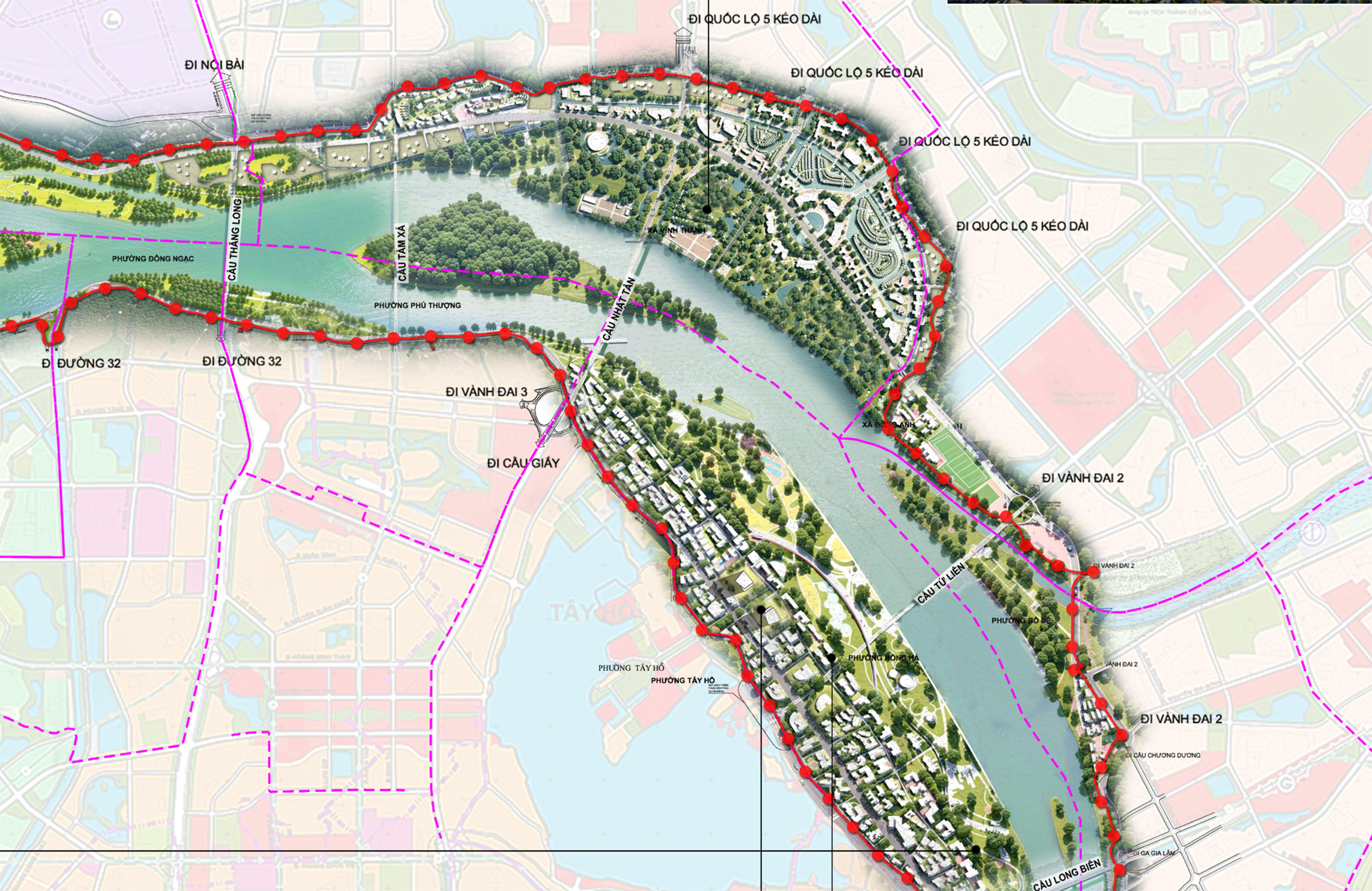
Spatial, architectural, and landscape organization diagram for the section from Hong Ha Bridge to Nhat Tan.
 |
Section from Thang Long Bridge to Long Bien Bridge.
 |
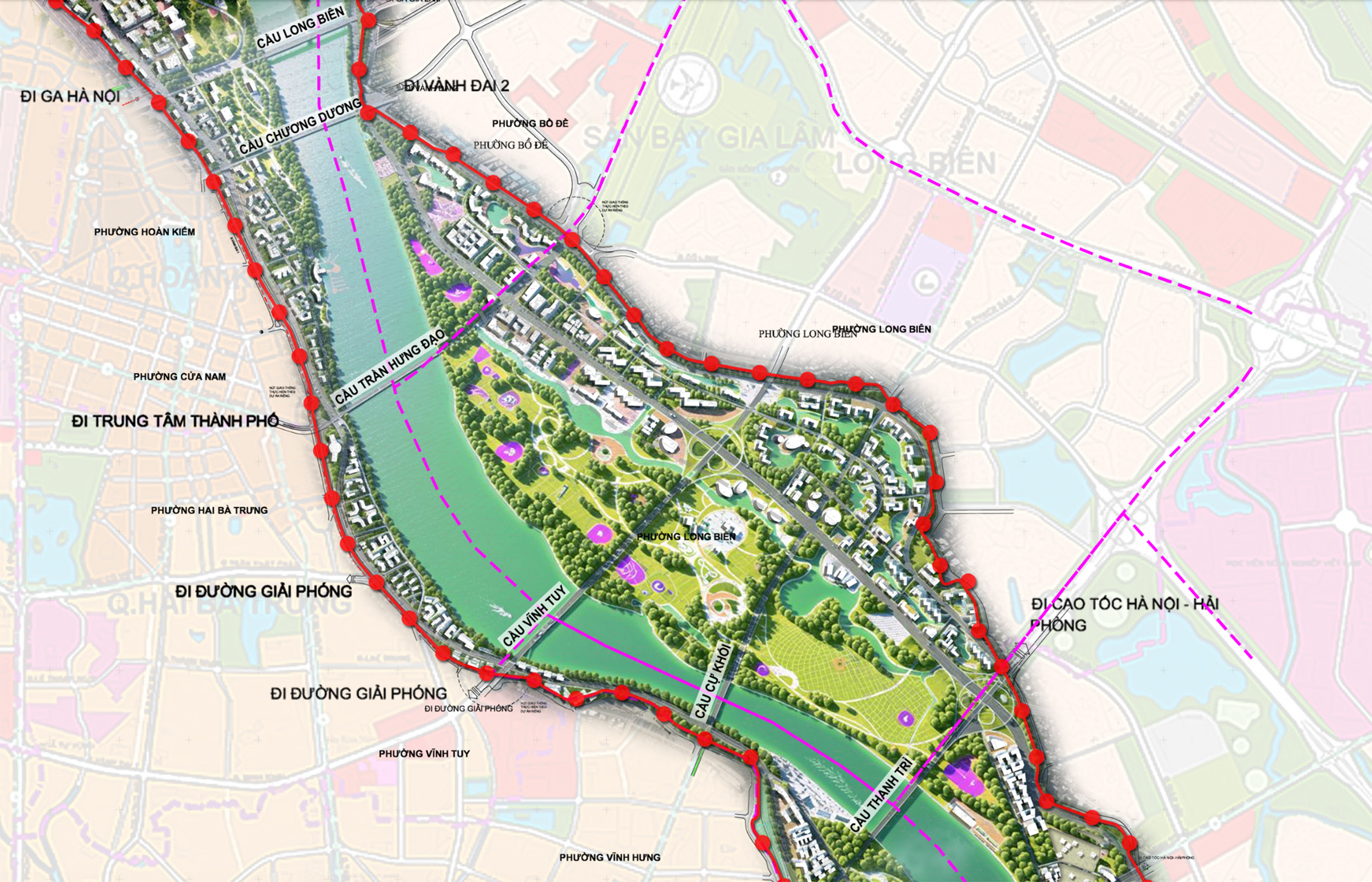
Section from Long Bien Bridge to Thanh Tri Bridge.
 |
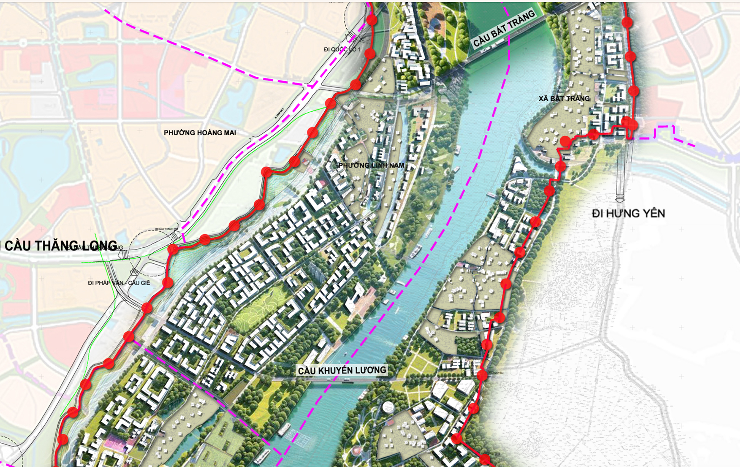
Section from Bat Trang Bridge to Khuyen Luong Bridge.
 |
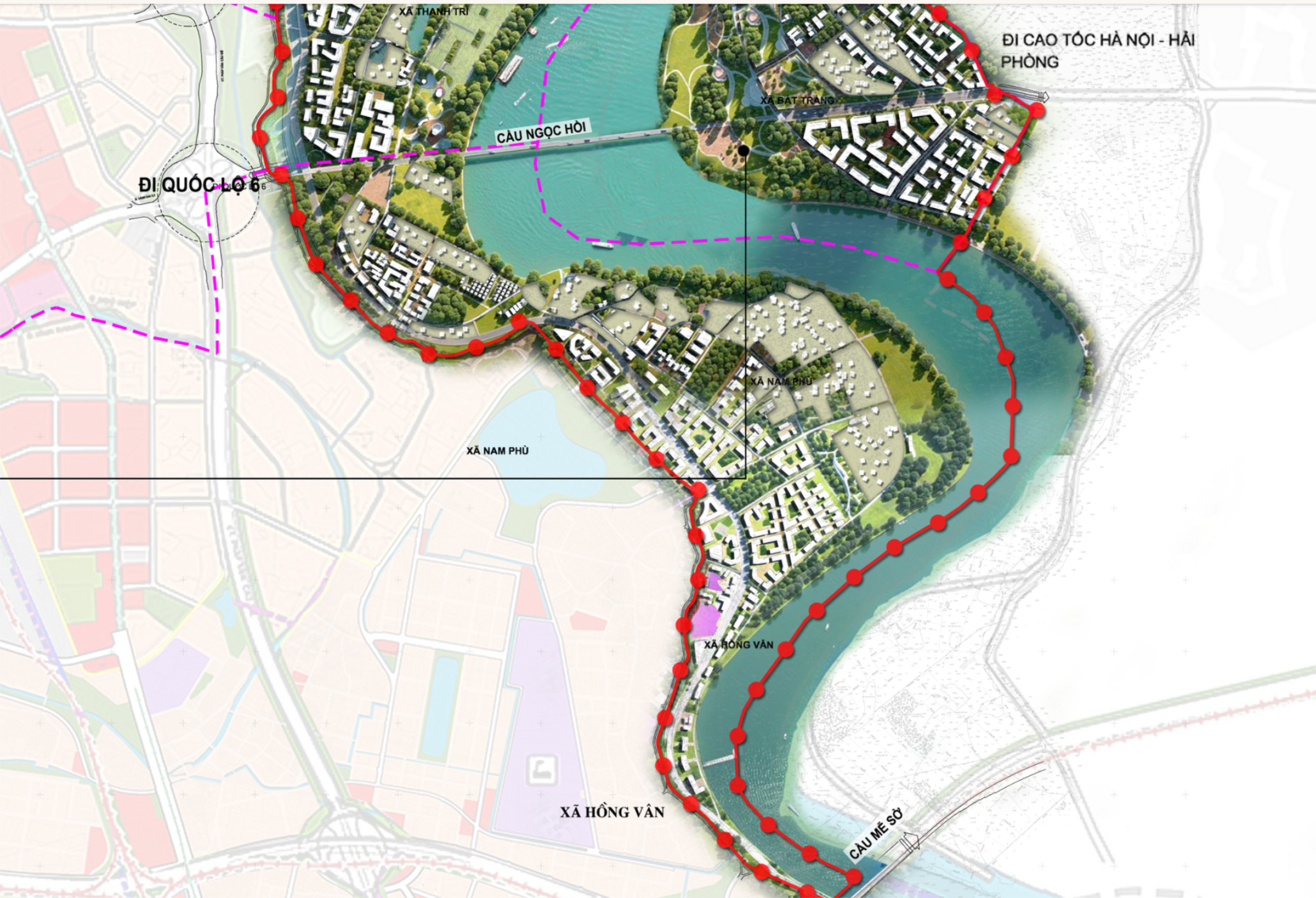
Section from Ngoc Hoi Bridge to Me So Bridge.
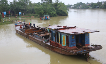
Beyond the park clusters, the plan aims to connect road, waterway, and urban railway transportation, including a system of 17 river-crossing bridges along the scenic boulevard axis. It also seeks to gradually convert cargo ports into tourist ports and improve waterways.
The Red River flows for over 120 km through Hanoi. The project's research scope covers approximately one-third of the total river length within the capital.
Hong Chieu