 |
In the early 20th century, the Red River banks, now Tran Nhat Duat street, featured numerous docks for boats.
 |
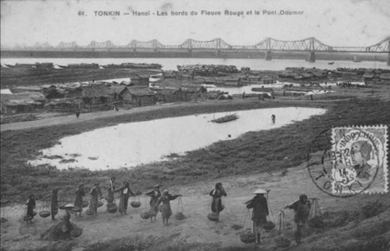
The Red River banks in 1902, now Hong Ha ward. 1902 also marked the inauguration of Long Bien bridge, the first and longest steel bridge in Indochina at the time, connecting Hanoi with northern provinces and Hai Phong, completely transforming transportation.
Co Xa village around 1903. This was one of the few settlements located close to the Red River's edge. Formerly known as An Xa, the village was renamed Co Xa in 1132 during the Ly Thuan Tong era, associated with Co Xa bank, a stretch of land along the Red River. Later, due to changes in the Red River's course, Co Xa village separated into several residential areas. Co Xa Bac Bien now belongs to Ngoc Thuy (Long Bien). Co Xa Nam Xa is part of the Bach Dang area (Hai Ba Trung). Co Xa Trung Chau is situated in the middle of the Red River.
 |
A steamboat dock on the Red River around 1904, now Tran Nhat Duat street.
 |
The Red River banks in 1906, now Hong Ha ward. The image shows that, apart from Co Xa village, the riverbanks were gently sloping land with almost no houses.
 |
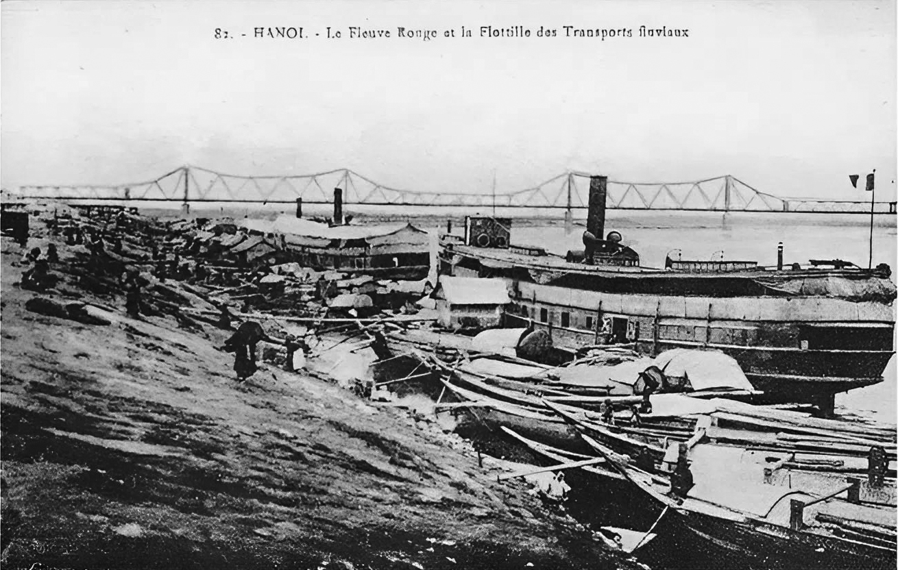
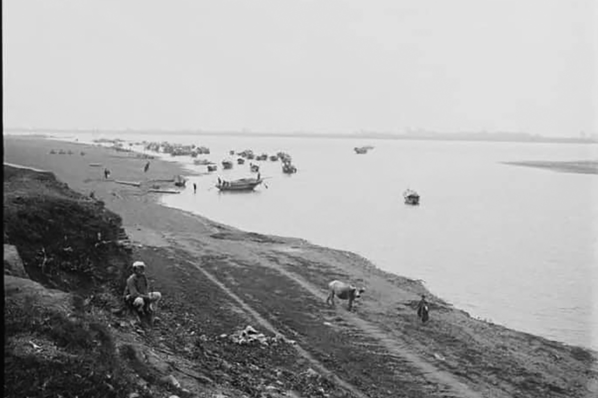
Workers on the riverbank, with Doumer bridge (Long Bien) in the background, in 1911.
 |
Boats and residential houses facing the Red River in 1926, now Tran Nhat Duat street.
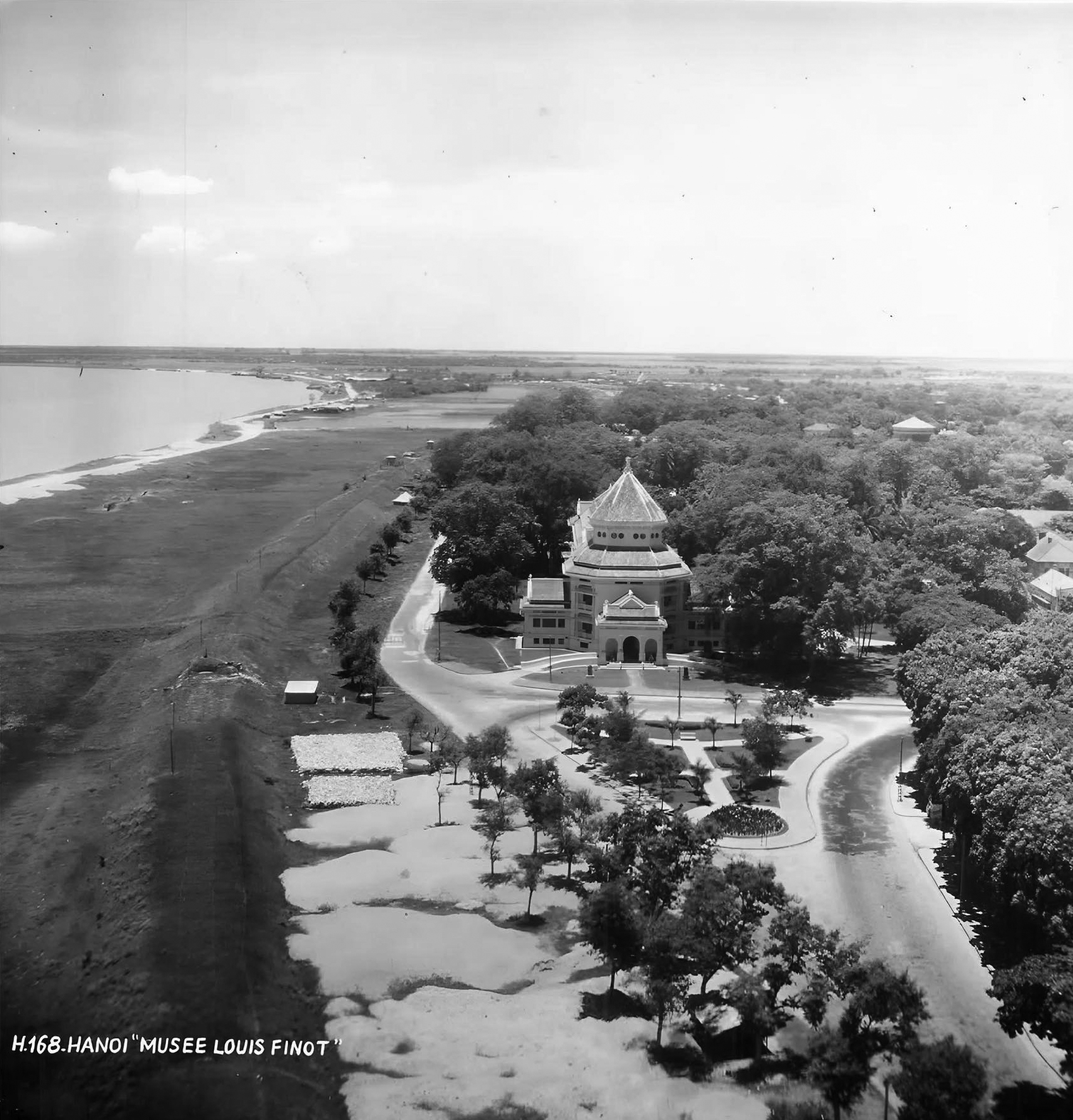 |
In 1926, the Red River dike section opposite the History Museum had no roads or riverside houses.
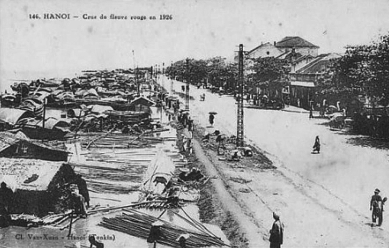
The Red River during the 1926 flood. *Photo: Belle Indochine*
 |
The Red River during the 1929 flood. *Photo: Belle Indochine*
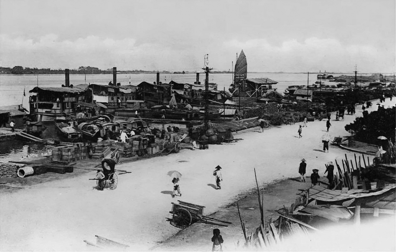
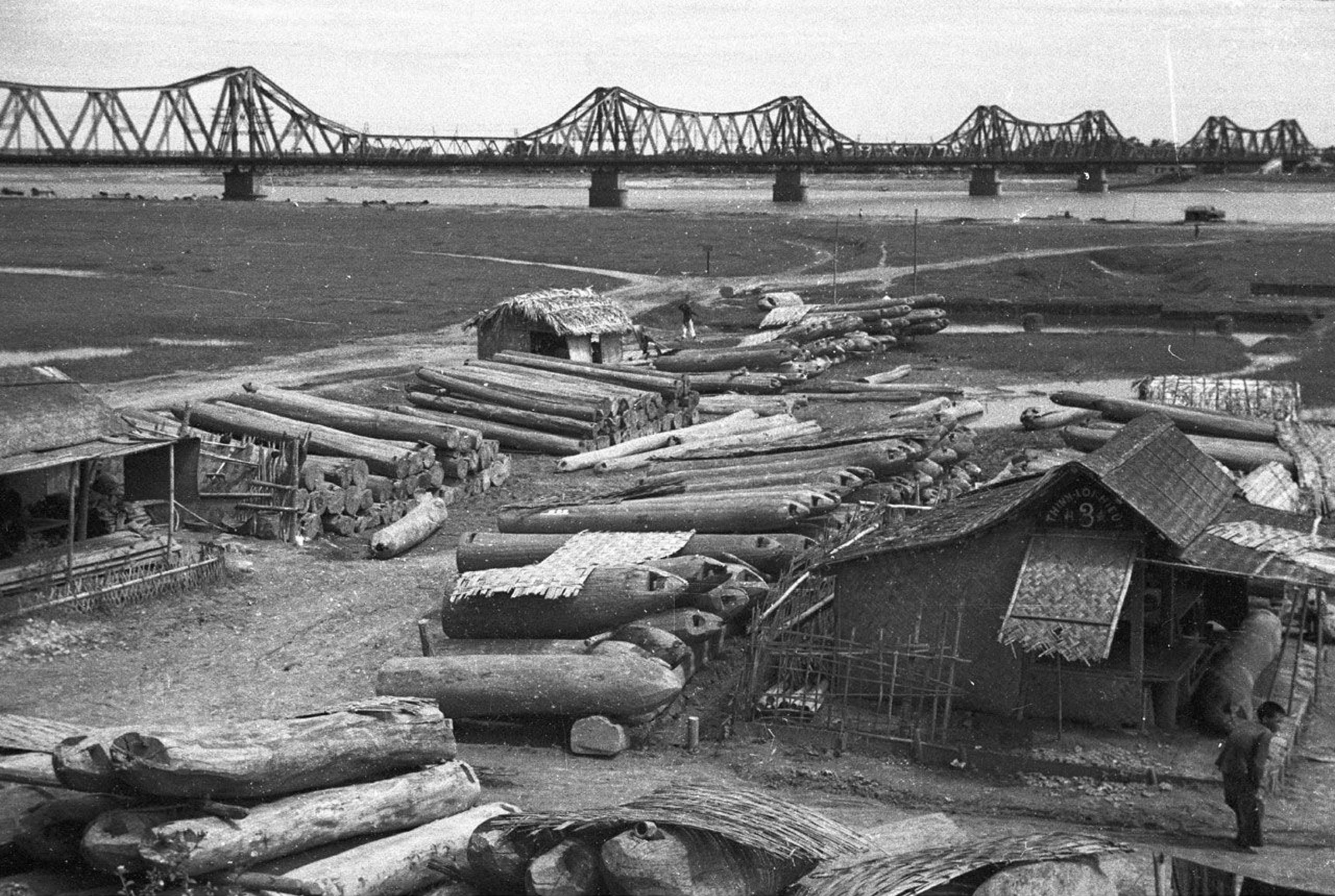
A timber collection point by the Red River dock. *Photo: Charles Peyrin*
The riverside dock area in photos taken between 1920-1930 by French photographer Charles Peyrin.
 |
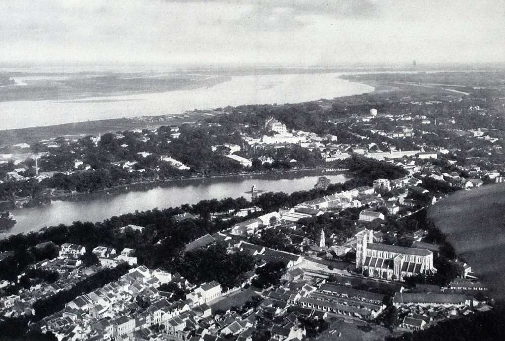
The Red River riverside area around 1930.
 |
The riverside banks in the 1940s. *Photo: Harrison Forman*
 |
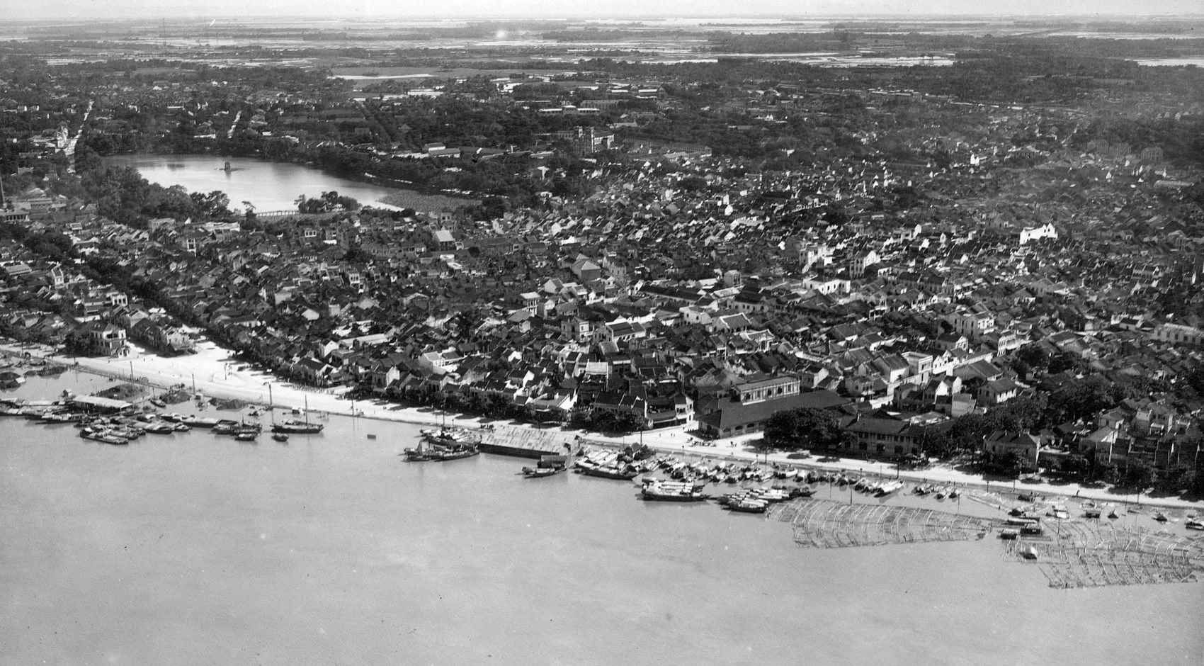
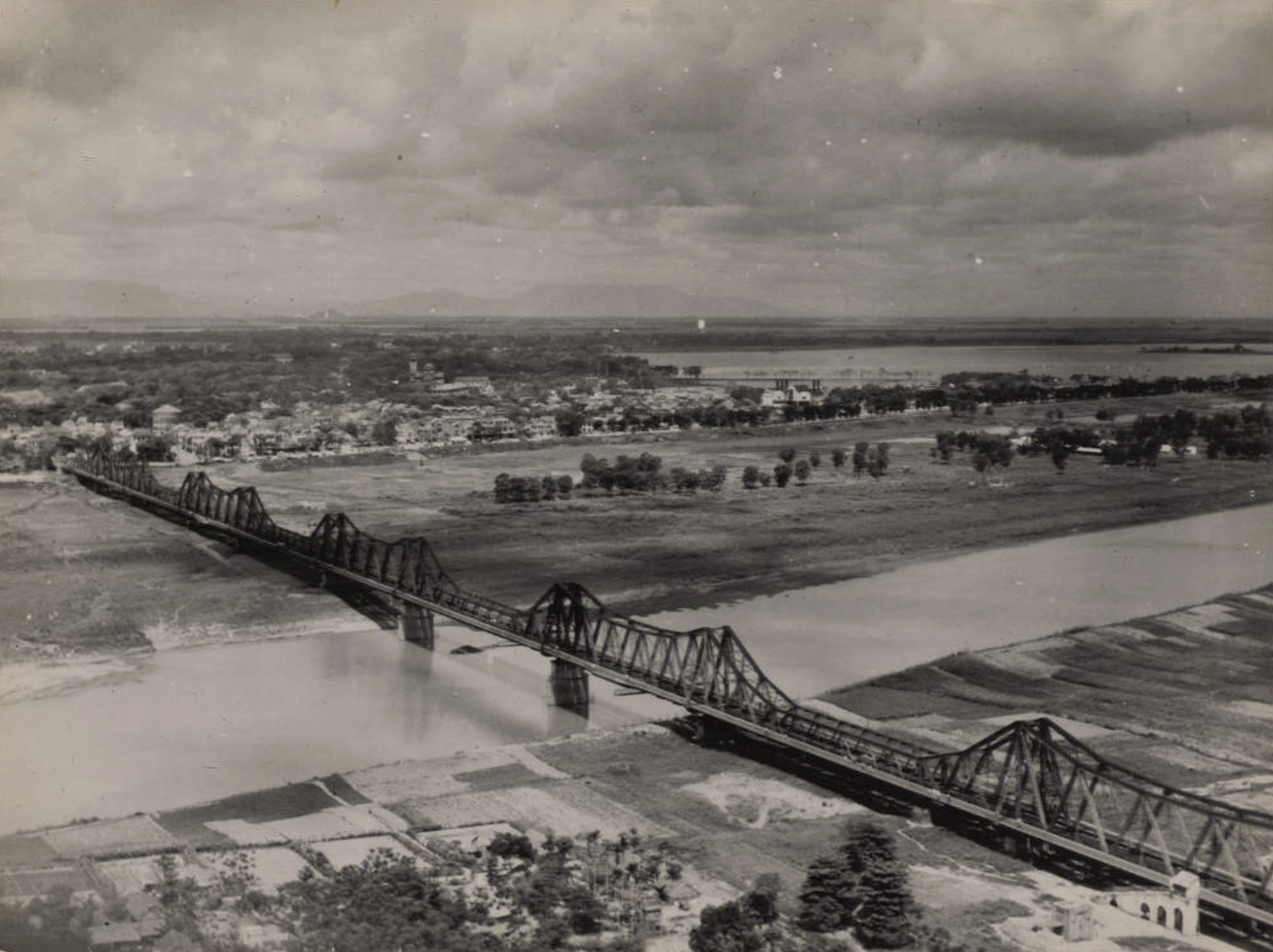
The Red River, its alluvial plains, and sandbanks below Long Bien bridge are clearly visible in this 1951 photograph.
Archival photos