On 15/11, the Quang Ngai Department of Construction announced that the road section poses multiple safety risks. The department is coordinating with local authorities to determine the cause and develop a plan to address the damage.
Currently, authorities have placed warning signs at both ends of the affected area, cordoned it off, and implemented traffic diversions for vehicles.
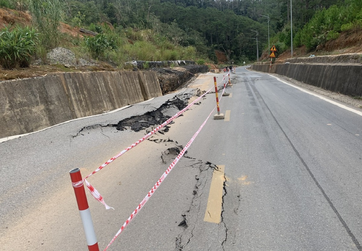 |
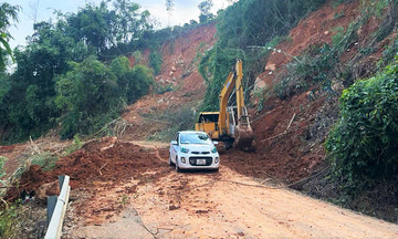
National Highway 24 cracked, with the section near the positive slope sagging. Photo: Truong Nhan |
National Highway 24 cracked, with the section near the positive slope sagging. Photo: Truong Nhan
According to the Mang Den Commune People's Committee, this section of road, which passes through Kopring village, had prior damage, and recent rain and floods caused an additional section to heave. Earlier in November, about 13 km from this location, National Highway 24 also experienced a 50 m long, 20 cm wide slope crack near Ba Tang slope.
National Highway 24 stretches approximately 170 km, beginning at Thach Tru intersection, passing through Ba To and Mang Den, and concluding in Kon Tum (now Quang Ngai). It serves as a vital link between the Northern Central Highlands and the South Central Coast. Quang Ngai province is requesting over VND 2,300 billion from the Central government to upgrade the highway, eliminate traffic bottlenecks, and support economic and tourism development.
Mang Den, situated at an altitude of 1,200 m, enjoys a cool climate and boasts over 75% forest cover, earning it the moniker "the second Da Lat". In 2024, the area welcomed over 1,2 million visitors, with a projected 1,5 million in 2025. The commune aims to become a National Tourist Area and a natural resort center by 2030.
Pham Linh