On 27/11, Khanh Hoa announced a sea ban effective from 07:00 tomorrow. All vessels and aquaculture rafts must secure safe shelter by 18:00 on the same day. Relevant departments and the border defense force are monitoring weather developments to inform fishermen about safe return to operations after the typhoon and guide secure production plans.
 |
Officers and soldiers in Truong Sa Special Administrative Region help fishermen secure their boats. Photo: Ngoc Anh |
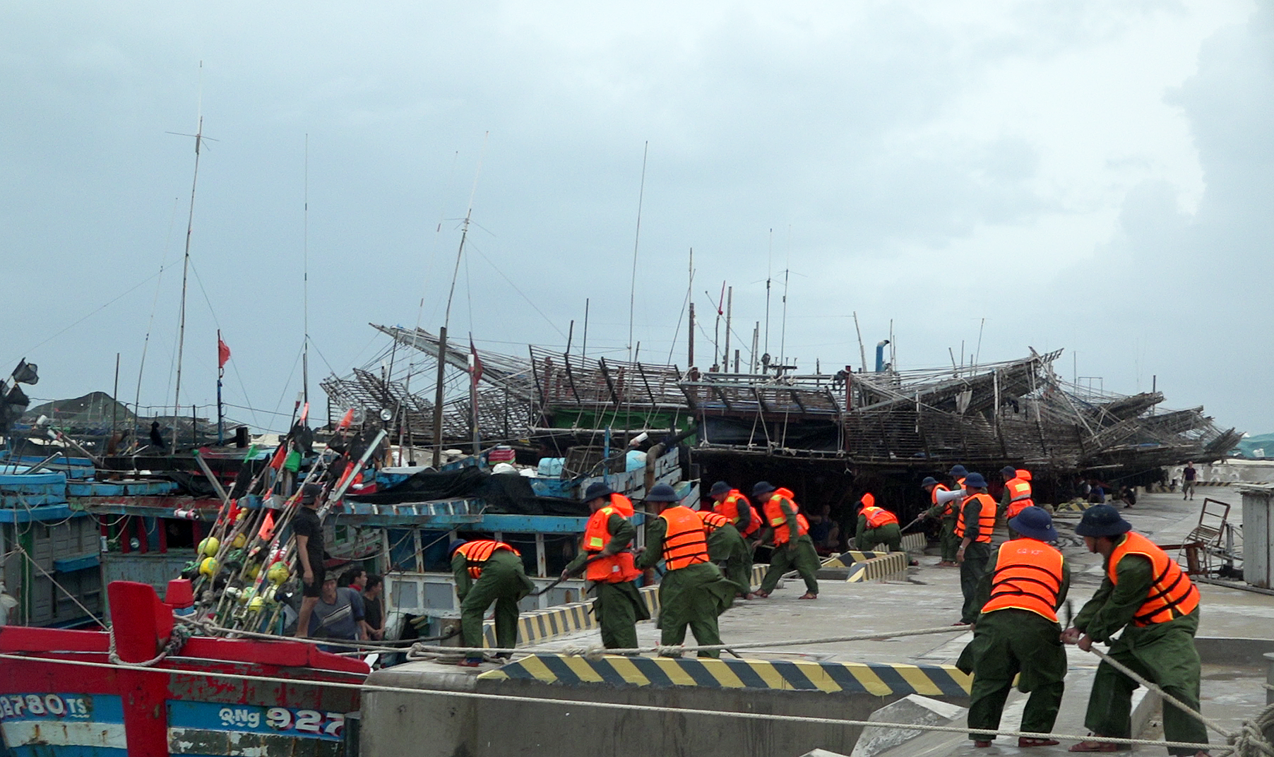
As of this afternoon, the Truong Sa Special Administrative Region (Khanh Hoa) has welcomed over 200 fishing boats carrying over 2,500 fishermen seeking shelter from the typhoon. Over 400 officers and soldiers were mobilized to assist residents in tying down vessels and reinforcing homes. Units on the island have provided over 20,000 liters of fresh water, essential supplies, and medicine, while also organizing medical examinations and temporary accommodation for the fishermen.
Dak Lak has also prohibited vessels from going to sea, requiring approximately 70 fishing boats to seek shelter. The province's irrigation and hydropower reservoirs need to release water to accommodate potential floods. Dak Lak has also developed an evacuation plan for nearly 23,000 people if the typhoon reaches level 9-10 with gusts up to level 12. An additional plan is in place to evacuate nearly 8,000 households, totaling 29,000 residents, if water levels in the Ba, Ky Lo, and Ban Thach rivers rise to alert levels 2-3.
In addition to imposing a sea ban, Gia Lai province has mandated a review of all reservoirs. The province currently has 143 full reservoirs and 155 overflowing ones. Following a previous typhoon and flood season that caused significant damage, resulting in 5 deaths and over 11,600 billion dong in economic losses, the province declared a state of emergency in 77 communes and wards to proactively respond before the typhoon makes landfall.
In Lam Dong, the Department of Agriculture and Environment has urged local authorities to implement preventative measures early. The border defense force is continuously broadcasting the typhoon's position and movement direction to help vessels steer clear of dangerous areas.
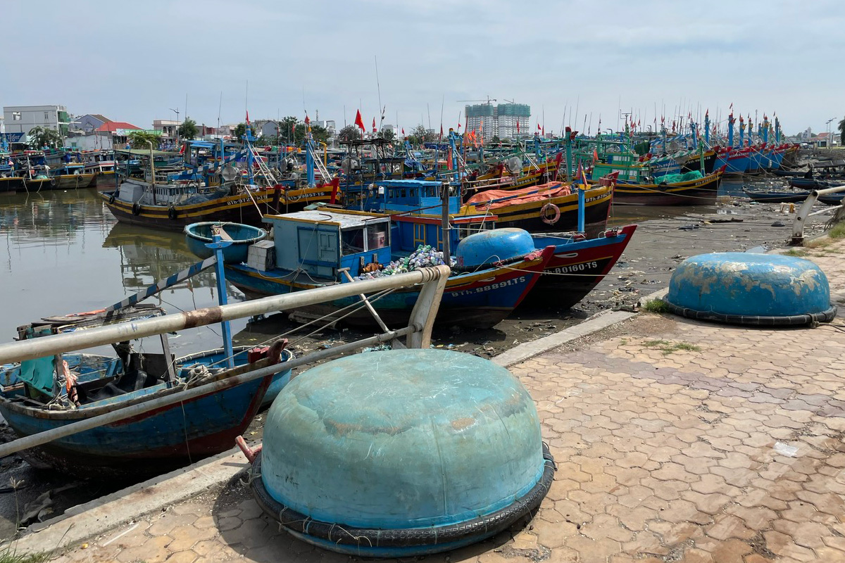 |
Boats docked on the Phan Thiet river, noon on 27/11. Photo: Viet Quoc |
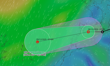
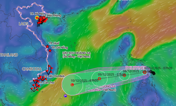
Typhoon Koto formed from a tropical depression east of the central Philippines, intensified into a typhoon, and entered the East Sea on the evening of 25/11. Starting this afternoon, the typhoon began to shift its course to the west-southwest, then turned back north-northwest, slowing to only three to 10 km/h. Its intensity is expected to remain at level 10-11 for the next two days.
The Japan Meteorological Agency reported that the typhoon currently has winds of 144 km/h. By 1/12, as it approaches the coastal mainland of Gia Lai, wind speeds are forecast to decrease to 90 km/h. The Hong Kong Observatory, however, suggests the typhoon could reach a peak intensity of 130 km/h in the coming hours, with winds rapidly decreasing to 75 km/h by 2/12 as it shifts northward.
Due to the typhoon's influence, the central East Sea (including the waters north of the Truong Sa Special Administrative Region) is experiencing strong winds of level 7-12, gusting to level 15, with waves four to nine meters high. Early tomorrow morning, offshore waters from Gia Lai to Khanh Hoa will see strong winds of level 6-8, gusting to level 9-10, and waves five to seven meters high. All vessels operating in these dangerous areas are likely to be affected.
The year 2025 has recorded the highest number of typhoons and tropical depressions in the past 30 years. Natural disasters, primarily typhoons and floods, have resulted in 409 deaths, 727 injuries, and economic damage exceeding 85,000 billion dong.
Bui Toan - Viet Quoc - Tran Hoa