The National Center for Hydro-Meteorological Forecasting announced that on the morning of 31/7, the super typhoon's eye was over 4,200 km east of Luzon Island, Philippines. Over the next one to two days, it is expected to move mainly west-northwest at approximately 20 km/h, continuing to strengthen. Wind speeds near the eye could reach about 213 km/h.
From 3/8, the super typhoon will shift its trajectory from west-northwest to west, moving at about 25 km/h, and heading towards the Fujian - Zhejiang region of China.
The Japan Meteorological Agency maintains its forecast that the typhoon will reach its peak tomorrow with winds of 216 km/h. Meanwhile, the U.S. Navy suggests the typhoon could reach 250 km/h, rather than nearly 270 km/h as predicted yesterday. All agencies assess that the typhoon will not enter the South China Sea.
The National Center for Hydro-Meteorological Forecasting stated that from around 5/8, as the super typhoon approaches the north of Taiwan Island, China, its circulation will strongly draw in the southwest monsoon, causing winds in the southern South China Sea to intensify.
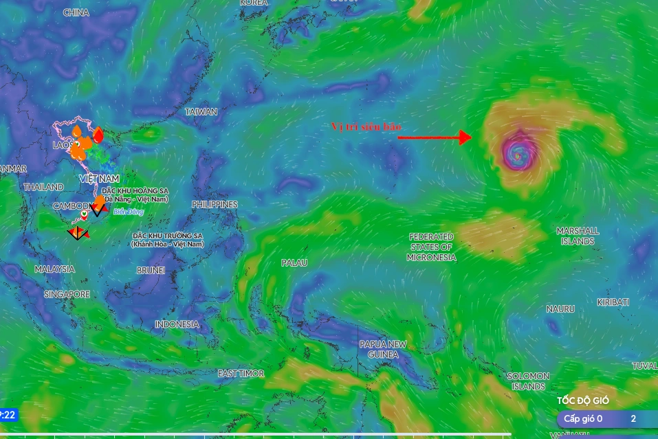 |
Super Typhoon Dolphin's position on the morning of 31/7. *Image: Disaster Monitoring System* |
By approximately 6-7/8, southwest winds across most of the northern, central, and southern South China Sea, including the waters of the Hoang Sa and Truong Sa archipelagos – traditional fishing grounds for Vietnamese fishermen – are likely to reach force 6-7, with waves 2-4 meters high.
So far this year, the northwestern Pacific region has experienced four super typhoons: Sinlaku, Bavi, Mekkhala, and Dolphin. The South China Sea has recorded two typhoons: Maysak and Noul. Typhoon Maysak, in early July, caused no human casualties but damaged 96 homes, drifted or sank 13 boats and rafts, affected approximately 1,100 hectares of aquaculture, with total damages estimated at 20 billion VND.
According to meteorological agency forecasts, this year's typhoon season is expected to have a number of typhoons and tropical depressions in the South China Sea that are similar to or lower than the multi-year average. Despite this, the storms could be strong, have complex trajectories, and still pose risks of strong winds at sea, heavy rain, flash floods, and landslides in many areas.
Gia Chinh