The halong.navy01.com application divides Ha Long Bay and Bai Tu Long Bay into nine distinct warning areas. This precise localization helps prevent unnecessary widespread operational halts, minimizing disruption to tourism and fishing activities.
According to the Quang Ninh Department of Agriculture and Environment, the application integrates real-time data from observation networks, satellite imagery, and two major meteorological radar stations: the Northeast Hydrometeorological Station in Hai Phong City and Viet Bac in Phu Tho. With high scanning density and resolution, the system can identify storm cloud clusters early, determine their intensity, classify lightning, and predict the movement of heavy rain areas.
Signs of adverse weather in the bay are warned approximately 30 minutes in advance. This provides sufficient time for captains, fishermen, and tourists to take precautions and guide vessels to safe shelters.
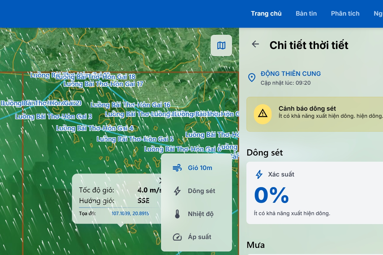 |
Weather information for Thien Cung cave area at 9:30 AM on 28/7, displayed on halong.navy01.com.
Beyond management purposes, the halong.navi01.com website is publicly accessible. Residents, boat owners, and tourism businesses can directly access it via phone or computer to monitor real-time weather developments.
Doan Manh Phuong, Head of the Quang Ninh Provincial Department of Irrigation, stated that during its trial run, the system demonstrated relatively accurate warning results for thunderstorm, squall, and lightning situations.
Thunderstorms and lightning at sea often appear rapidly, cover a narrow area, but possess high intensity. Proactive implementation of early warning technology is expected to minimize loss of life and property, while reinforcing Quang Ninh's image as a safe tourist destination.
One year ago, on 19/7/2025, the Vinh Xanh 58 boat, carrying 49 people, capsized in Ha Long Bay due to an unexpected squall, resulting in 39 deaths and ten rescued. This incident exposed gaps in vessel monitoring and abnormal incident warnings. The Vinh Xanh boat's GPS tracking system lost connection at 2:05 PM, but the Border Guard only received the accident report at 3:30 PM.
Following this incident, Quang Ninh collaborated with the Institute of Earth Sciences to deploy a thunderstorm, squall, and lightning warning system at key locations, particularly in Ha Long Bay and Bai Tu Long Bay. Currently, 100% of vessels operating in the bay are equipped with GPS tracking devices. This system continuously updates vessel position, speed, and route, enabling management agencies to detect anomalies promptly and issue early warnings.
Quang Ninh currently has over 4,200 fishing boats and hundreds of tourist boats operating regularly at sea. Most vessels are equipped with GPS navigation systems, automatic identification system (AIS) devices, and VHF communication radios.
Le Tan