On the afternoon of 13/9, Con Co island district recorded strong winds of level 6-7, with gusts reaching level 8. Dong Hoi (Quang Tri) and Ky Anh (Ha Tinh) experienced winds of level 6, with gusts of level 8. The National Center for Hydro-Meteorological Forecasting stated that the tropical depression continued to move further inland into central Laos during the evening and night of the same day, before weakening and dissipating.
According to the Vietnam Disaster Management Authority, by 17:00 on 13/9, rain and floods damaged 9 houses, including 5 in Quang Tri and 4 in Hue. Additionally, 409 houses in Quang Tri were flooded. Local authorities evacuated 694 households to safety, comprising 645 households in Quang Tri, 44 in Da Nang, and 5 in Hue.
The floods also caused congestion at 5 locations on national and provincial roads, specifically National Highway 15D, Provincial Roads 588A and 586 in Quang Tri, and Provincial Road 17B in Hue. Furthermore, 48 bridges, tran culverts (submerged roads), and inter-commune roads were inundated by 0,2-0,8 meters of water, with some areas exceeding one meter, causing local isolation. Quang Tri had 36 such locations, and Hue had 12.
River levels in Quang Tri continue to rise. The lower Kien Giang River is at alarm level one, while the Thach Han River is approximately 0,1 meter below alarm level three. In Hue, the Bo and Huong rivers are above alarm level one, while water levels in Da Nang's rivers are gradually receding.
The meteorological agency warns that 114 communes and wards face a risk of flash floods and landslides tonight. Among these, Quang Tri accounts for 52 units, Da Nang 25, Hue 21, and Ha Tinh 16.
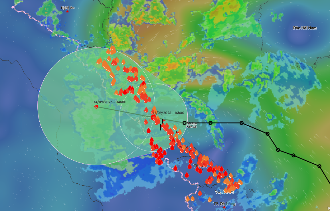 |
The tropical depression entered Quang Tri on the afternoon of 13/9. Photo: Disaster Monitoring System |
From now until 16/9, the Thach Han River could exceed alarm level three by approximately 0,5 meters, and the lower Kien Giang River could surpass alarm level two. The Ngan Sau and Ngan Pho rivers in Ha Tinh may reach alarm levels two to three. Other rivers are generally at alarm levels one to two, with some areas experiencing higher levels.
The center of heavy rain is gradually shifting northward. From the evening of 13/9 to 15/9, Nghe An and northern Quang Tri (the former Quang Binh province area) are forecast to receive 200-400 mm of rain, with some places exceeding 500 mm. Thanh Hoa and southern Quang Tri (part of the former Quang Tri province area) expect 150-300 mm of rain, with some areas receiving over 400 mm.
From early morning of 14/9 until the end of 16/9, heavy rain will spread to the midland and delta regions of the Northern Delta, with widespread rainfall of 100-250 mm, and some areas exceeding 300 mm.
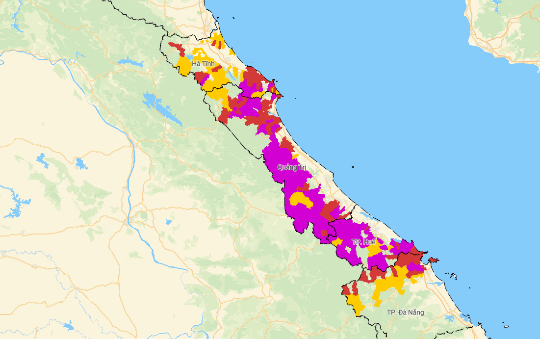 |
Map of landslide and flash flood risk (purple indicates very high risk). Photo: Department of Meteorology and Hydrology |
Before making landfall, the tropical depression combined with a tropical convergence zone to bring heavy rain from Ha Tinh to Hue. From the evening of 12/9 to the afternoon of 13/9, Quang Tri and Hue generally received 150-250 mm of rain, with some areas exceeding 350 mm. Rainfall at Ta Long reached 480 mm, and Ba Nang 397 mm, both in Quang Tri. Ta Luong in Hue recorded 396 mm.
From 10/9 to 13/9, Ta Long recorded a total rainfall of 834 mm, and the La To hydropower dam received 757 mm. In Hue, Bach Ma peak recorded 1.300 mm, Nham 767 mm, Ta Luong 762 mm, and the Rao Trang 3 hydropower dam measured 733 mm.
Gia Chinh