The National Center for Hydro-Meteorological Forecasting reported that at 4 p.m., Typhoon Tapah was located in the northeastern part of the East Sea, with maximum sustained winds of 74 km/h (level 8) and gusts two levels higher. It is moving northwest at a speed of 15 km/h.
By 4 p.m. tomorrow, when the typhoon is about 420 km northeast of the Paracel Islands, it is expected to intensify to levels 9-10, with gusts reaching level 12. The typhoon is expected to maintain its course, with a reduced speed of 10-15 km/h, and may strengthen further as it approaches the coast of Guangdong, China.
By 4 p.m. on 8/9, the typhoon will be approximately 110 km south-southeast of Hong Kong, with maximum sustained winds of level 10 and gusts of level 13. It is expected to maintain its course and speed, further intensifying before making landfall in Guangdong.
 |
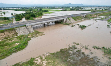
Forecast track and impact area of Typhoon Tapah at 4 p.m. today. Photo: NCHMF |
Forecast track and impact area of Typhoon Tapah at 4 p.m. today. Photo: NCHMF
The Japan Meteorological Agency forecasts that the typhoon will reach a peak intensity of 72 km/h. After making landfall in Guangdong, it will move westward, and the weakened low-pressure area will affect the mountainous regions of Vietnam. The Hong Kong Observatory estimates that the typhoon's maximum sustained winds could reach 90 km/h, and the affected areas after weakening will include the provinces of Ha Giang, Cao Bang, and Lang Son.
Due to the typhoon, the northeastern part of the East Sea will experience strong winds of levels 6-7, increasing to levels 7-8, with the area near the typhoon's center experiencing winds of levels 9-10 and gusts up to level 13. Waves are expected to reach 3-5 meters high. Vessels operating in these dangerous areas are likely to be affected.
Last night, the Ministry of Agriculture and Rural Development issued an urgent dispatch requesting coastal provinces from Quang Ninh to Dak Lak to closely monitor the development of the tropical depression. They were instructed to inform vessels of the typhoon's location and path for proactive prevention. Local authorities were also asked to prepare rescue forces for deployment if needed.
Since the beginning of the year, there have been seven typhoons in the East Sea. Most recently, Typhoon Nongfa (No. 6) made landfall in Ha Tinh - north Quang Tri with weak intensity and minimal damage. Typhoon Kajiki (No. 5) hit Thanh Hoa - Ha Tinh on 25/8, causing 9 deaths and missing persons, injuring 77 people, damaging over 38,600 houses (510 collapsed), and resulting in total economic losses of about 2,900 billion VND.
The National Center for Hydro-Meteorological Forecasting predicts that from now until the end of the year, there will be 5-7 typhoons or tropical depressions in the East Sea, with 2-3 directly impacting the mainland, mainly from central Vietnam southward. Cold air is forecast to arrive early, which may lead to complicated flooding and rain at the end of the year.
Gia Chinh