According to the National Center for Hydro-Meteorological Forecasting, at 7 a.m. today, the typhoon's center was located north of the Lei Zhou Peninsula (China), approximately 220 km east of Quang Ninh - Hai Phong. Maximum sustained winds reached 88 km/h, equivalent to a category 9 storm, with gusts reaching category 11. The typhoon is moving west-southwest at 15-20 km/h.
By 7 a.m. on 22/7, the typhoon is forecast to strengthen to category 10-11, with gusts reaching category 14 while over the northern Gulf of Tonkin, and may intensify further. It is then expected to make landfall between Thanh Hoa and Nghe An provinces and weaken into a low-pressure area over Upper Laos.
The Japan Meteorological Agency forecasts the typhoon may weaken to 90 km/h upon entering the Gulf of Tonkin but will re-intensify to 108 km/h as it approaches Quang Ninh - Hai Phong. Meanwhile, the Hong Kong Observatory predicts the typhoon will maintain its intensity at 90 km/h as it enters the Gulf of Tonkin, with the center potentially making landfall between Ninh Binh and Thanh Hoa.
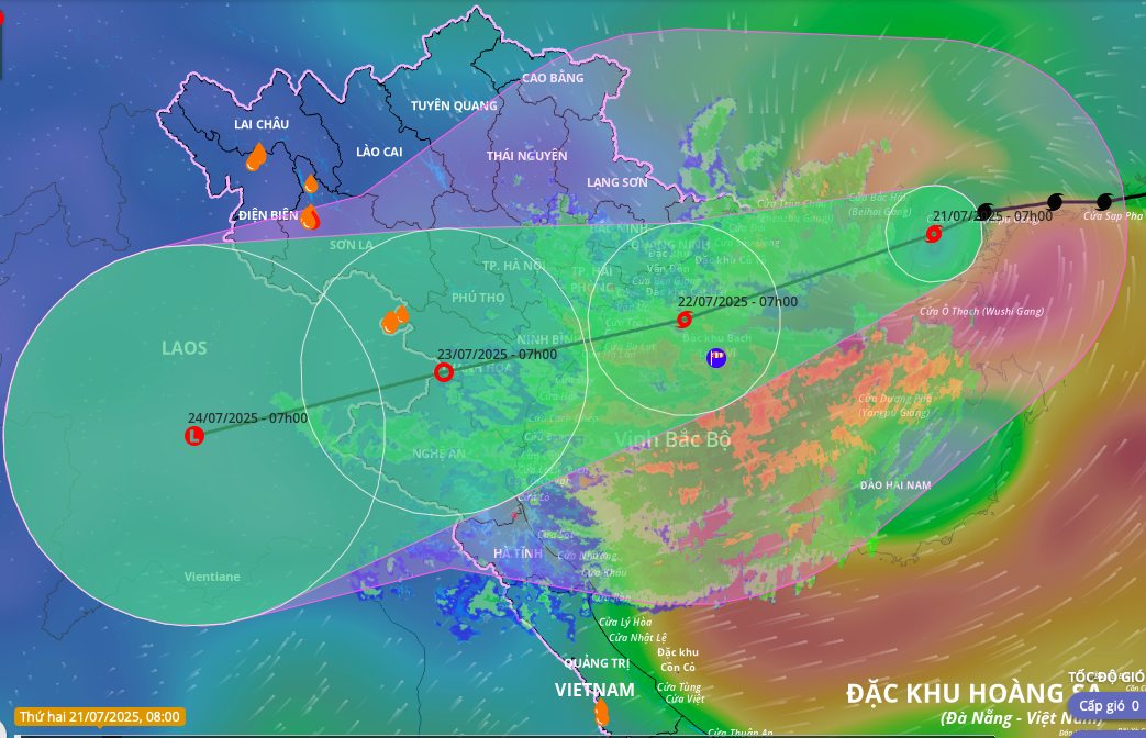 |
Projected path and impact zone of Typhoon Wipha. Image: Disaster Monitoring System |
Projected path and impact zone of Typhoon Wipha. Image: Disaster Monitoring System
The typhoon's influence is bringing strong winds of category 7-8, with gusts up to category 10, and waves of 3-5 meters to the northwestern South China Sea. In the northern Gulf of Tonkin (including Bach Long Vi, Co To, Van Don, Cat Hai, and Hon Dau), winds are gradually increasing to category 6-7, then to 8-9, with 10-11 near the typhoon's center and gusts reaching category 14; waves will reach 3-5 meters. The southern Gulf of Tonkin (including Hon Ngu island) will experience winds of category 6-7, increasing to 8-9 near the typhoon's center, with gusts up to category 11, and waves of 2-4 meters.
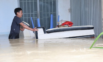
Coastal areas from Hung Yen to Quang Ninh may experience storm surges of 0.5-1 meters. Water levels at Hon Dau (Hai Phong) are projected to reach 3.7-4.1 meters; at Cua Ong (Quang Ninh) 4.4-4.8 meters; and Tra Co 3.6-4 meters. The risk of flooding in estuaries and coastal areas on the afternoon of 22/7 is considered high.
Starting the night of 21/7, coastal areas from Quang Ninh to Nghe An will experience strong winds of category 7-9, with 10-11 near the typhoon's center and gusts reaching category 14. Inland areas will experience winds of category 6, with gusts of 7-8. Category 10-11 winds can cause trees and power poles to fall and roofs to be blown off.
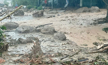
From 21-23/7, the Northeast region, the Red River Delta, Thanh Hoa, and Nghe An are forecast to receive 200-350 mm of rainfall, with some areas exceeding 600 mm. Other localities in the northern region and Ha Tinh will receive 100-200 mm, with some areas exceeding 300 mm. Localized heavy rain may exceed 150 mm in three hours, causing flash floods, landslides in mountainous areas, and flooding in low-lying areas.
In an online meeting with 1,700 communes and wards on the morning of 20/7, Deputy Prime Minister Tran Hong Ha requested specialized agencies closely monitor developments and accurately assess the scale, intensity, and impact of the typhoon. Localities must review their response capacity after mergers, ensuring unified direction and effective coordination between forces.
In preparation for the typhoon, Quang Ninh province has banned all tourist boats on Ha Long Bay and island routes. Vessels are allowed to return to shore to disembark passengers but are not permitted to leave port again. Ninh Binh province has implemented a sea ban from 7 a.m. on 21/7 and is evacuating residents from vulnerable dyke areas before noon. Hung Yen province implemented a sea ban from 6 p.m. on 20/7, and Hai Phong from 5 p.m. on the same day.