The US National Oceanic and Atmospheric Administration (NOAA) updated its El Nino warning mid-week, indicating a 25% probability of a "super strong" intensity. This rare phenomenon has occurred three times in the past four decades. Meteorologists anticipate it will become pronounced between May and July, with a 61% probability, earlier than initial forecasts.
An analysis combining data from the North American Seasonal Forecast System (including NOAA, NASA, and regional models) and the European Centre for Medium-Range Weather Forecasts (ECMWF) led Severe Weather to conclude that Earth is preparing for its strongest super El Nino in decades.
What is a super El Nino?
El Nino represents the warm phase of the El Nino Southern Oscillation (ENSO), a natural climate fluctuation in the tropical Pacific. This phenomenon, which also includes the cold La Nina phase and a neutral phase, typically occurs every two to seven years and lasts about nine to twelve months.
A super El Nino specifically refers to a very strong El Nino event where ocean surface temperatures rise by at least 2 degrees Celsius above average. According to CNN, such events were recorded in 1982-1983, 1997-1998, and 2015-2016. Scientists note that while the most recent El Nino did not reach "super" intensity, it contributed to 2024 becoming a record-hot year for Earth.
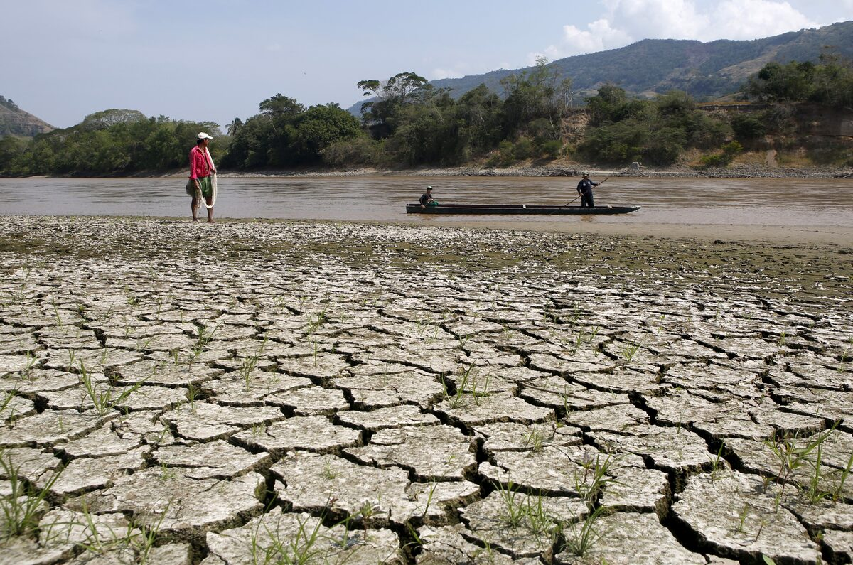 |
Fisherman Gabriel Barreto stands on the bank of the Magdalena River, the longest river in Colombia, Honda city, 14/1/2016. Photo: Reuters
How does it affect the planet?
If this super El Nino forms, CNN reports it will redraw the global weather map, triggering floods, droughts, and wildfires in various regions while accelerating the pace of global warming.
The 2015-2016 event resulted in a record-breaking hurricane season in the central North Pacific, leading to water shortages in Puerto Rico and drought in Ethiopia. The year 2016 also recorded the highest global temperatures in history, a record subsequently surpassed in 2023, 2024, and 2025.
Warmer waters in the central and eastern tropical Pacific could foster more severe storms. Historically, areas like the southeastern United States and Texas experienced increased rainfall, while southern Africa endured severe heatwaves and droughts, leading to crop damage and famine. Conversely, reduced rainfall and higher temperatures in Indonesia and Australia exacerbated wildfires.
El Nino's influence can create a domino effect on wildlife populations. A 2006 study in the journal Biological Conservation noted a significant decline in the Galapagos Islands' penguin population following two strong El Nino events in the 1980s and 1990s. Warmer oceans diminish nutrient levels and fish stocks, leading to starvation among some penguin colonies.
Climatically, this phenomenon tends to release vast amounts of heat stored in the ocean back into the atmosphere, thereby increasing the global average surface temperature. Should a strong El Nino develop and persist through winter, 2026 and 2027 are projected to set new planetary temperature records.
Meteorologists describe climate change as a gradual global warming, akin to ascending an escalator. In this analogy, an El Nino year is like "skipping a step" up or down the escalator, causing the climate to reach new records in a short period.
Nat Johnson, a meteorologist at NOAA, stated that uncertainties remain regarding the upcoming El Nino phenomenon, with various forecast outcomes, particularly concerning its intensity. This is because computer model forecasts made in spring typically have lower accuracy compared to other times of the year. In its latest announcement, NOAA indicated it would update its ENSO cycle forecast next month.
Bao Bao (according to CNN, National Geographic, Severe Weather)