The Institute of Earth Sciences reported that tremors occurred from 5h to 8h in Tra Linh commune (Da Nang) and Mang But commune (Quang Ngai), two areas approximately 20 km apart. The day before, Mang But also experienced three earthquakes measuring 2,8-3,4 magnitude.
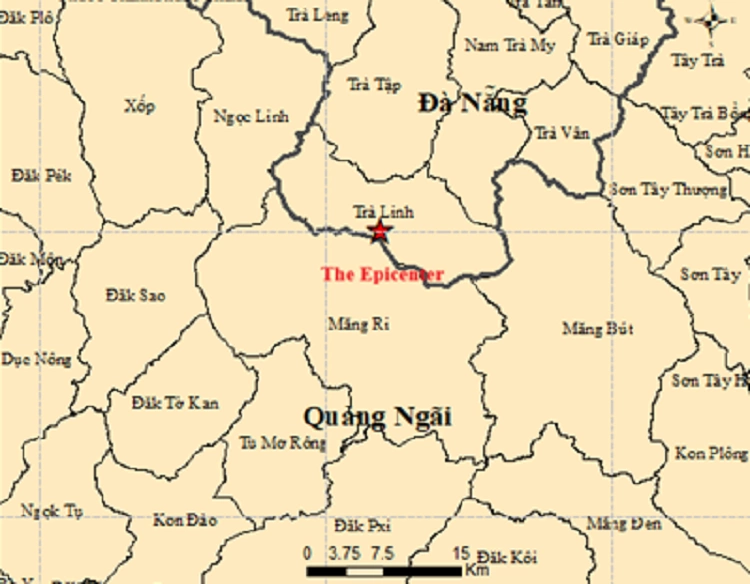 |
The earthquake at 06h 24 minutes on the morning of 22/4 in Tra Linh commune, Quang Ngai. Photo: *Director of the Institute of Earth Sciences* |
Nguyen Xuan Anh, Director of the Institute of Earth Sciences, stated that while the earthquakes were registered under the Da Nang locality, they were primarily distributed within the former Quang Nam area, not Da Nang's inner city.
"These earthquakes are related to the source region within the former Quang Nam area, particularly neighboring Kon Plong and the Song Tranh 2 hydropower plant area," he said, adding that the region has previously recorded induced earthquakes, with the largest measuring 4,7 magnitude on 15/11/2012.
The institute's leadership assessed that seismic activity in the area is mainly small, moderate to weak, posing low risk.
Since 2021, the Kon Plong area (formerly Kon Tum) has recorded more than 1.000 earthquakes. Experts classify this as a weak earthquake zone, with a maximum intensity not exceeding 5,5 magnitude. Most tremors are identified as induced earthquakes, linked to the filling of hydropower reservoirs which increases pressure on fault zones.
Some quakes can cause widespread shaking. On 21/3, a 3,6 magnitude earthquake in Mang But was clearly felt by many coastal residents for a few seconds.
Pham Linh