Due to the impact of Typhoon 4, widespread rain occurred in Quang Ninh. Rainfall measured in Quang Ha was 235 mm, Mong Cai 119 mm, Binh Lieu 109 mm; Phinh Ho 194,2 mm, Trang Vinh Lake 174,2 mm, Doan Tinh 160,6 mm, and Tran Island 149,8 mm.
In the Van Don special economic zone, many residential areas in Cai Rong 1 and Cai Rong 2 neighborhoods experienced localized flooding. At noon on 22/8, heavy rain caused a landslide on an embankment slope near Van Don 2 bridge and deep flooding at the Khe Ngai intersection, hindering traffic.
The special economic zone's authorities mobilized vehicles and personnel to address the landslide, drain water, and ensure traffic safety for residents.
In Cua Ong ward, water at the Cua Ong market intersection rose about 20 cm, flooding many roads. Muddy water from the hillside also overflowed into some residents' homes in area 5A.
Do The Hieu, Chairman of the People's Committee (PC) of Cua Ong ward, stated that functional forces inspected affected areas and supported residents in overcoming the consequences.
The Quang Ninh Provincial People's Committee (PC) warned that the risk of floods, inundation, flash floods, and landslides continues to be complex due to the impact of Typhoon 4 and heavy rain. Local authorities are required to evacuate residents from dangerous areas, especially those at risk of landslides and flash floods affecting homes. Residents should not cross deeply flooded areas, swift-flowing water, submerged culverts, bridges, and drains with safety risks; they should regularly monitor warnings and comply with evacuation orders. In an emergency, residents can call hotline 112 for assistance.
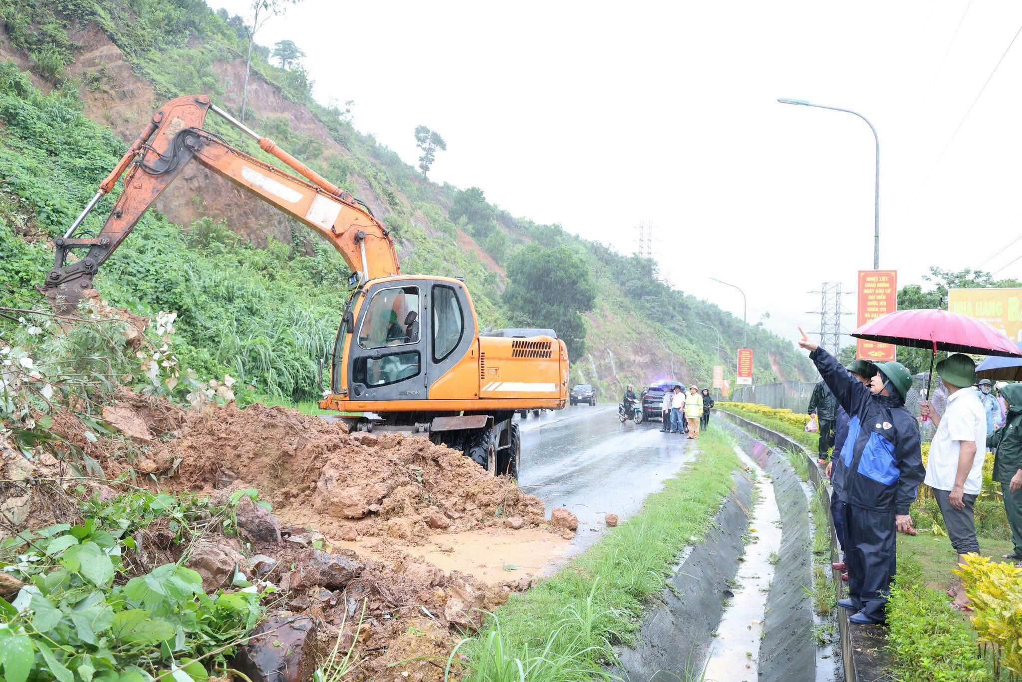 |
An embankment slope near Van Don 2 bridge collapsed. Photo: *Van Don special economic zone.* |
The meteorological agency forecasts that the Gulf of Tonkin and the coastal areas of Quang Ninh and Hai Phong may experience winds of level 6-7, near the eye of the storm level 8, with gusts of level 10, and waves 2-4 m high. Boats, aquaculture cages, anchorages, and coastal structures are at risk of damage.
On the coastal mainland of Quang Ninh and Hai Phong, winds may be strong at level 6-7, with gusts of level 8-9, causing damage to roofs, felling trees, billboards, and affecting power systems and traffic.
From 22/8 to the night of 24/8, the Northeast region, southern Phu Tho, and Thanh Hoa may receive 100-200 mm of rain, with localized areas exceeding 400 mm. Quang Ninh and Hai Phong may receive 250-350 mm, with localized areas exceeding 600 mm; Lang Son and Bac Ninh 200-300 mm, with localized areas exceeding 500 mm. Rain is likely to continue after 24/8, increasing the risk of urban flooding, flash floods, and landslides.
In Hanoi, the western circulation of Typhoon Narra may cause 100-200 mm of rain from 22/8 to the night of 24/8, with localized areas exceeding 200 mm, accompanied by a risk of inundation, thunderstorms, and strong gusts.
Le Tan