According to the Ga Ry Border Post, around 9h30, a section of the mountain at the headwaters, about 250 m from the local water reserve, collapsed. The large mass of earth spread over 200 m of road, extending about one km down to the stream, burying many farm huts (nha jun).
Earth and rocks flowing like water at the landslide site in Hung Son commune. Video: Provided by residents
Authorities identified three residents from Put village who were working on their farms at the time of the landslide. As of 15h today, they remain out of contact: Zo Ram Nho, a communal police officer; Briu Thi Tep, his wife; and Hoih Zi Nut.
Relatives stated that the three left home in the morning, some carrying phones, but could not be reached after the landslide. Due to a large volume of earth and rocks at the site that could collapse at any moment, authorities have not yet been able to organize a search.
Nguyen An, Secretary of Hung Son commune, reported that despite three days of dry, sunny weather in the area, the hill still collapsed. Access for forces is difficult, making it impossible to accurately assess the length and volume of the landslide.
The commune has cordoned off the hazardous area and is organizing a search for the missing individuals. All villages are instructed to conduct a census to identify any other potentially affected residents and warn people not to approach the site due to the risk of further collapse.
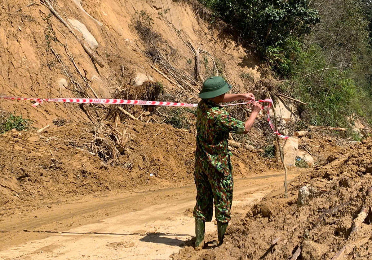 |
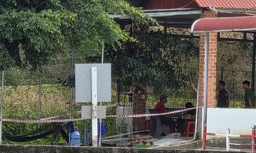
Authorities barricade the landslide area, keeping residents away for safety. Photo: Nam Em
According to Nguyen An, about 80 m of the road is buried. Authorities are concerned that in addition to the three local residents, transient individuals passing through during the landslide could also be at risk.
Hung Son commune has reported the incident to the city and requested support with personnel and equipment, including military assistance, to aid in the search and clear the road.
Hung Son is a commune bordering Laos, formerly part of the mountainous Tay Giang district in Quang Nam. The majority of its residents are Co Tu ethnic people who rely on farming. The former mountainous area of Quang Nam is considered one of the central region's highest landslide risk zones due to its steep terrain, weak geology, and prolonged rains that saturate the soil.
During the flood season in late October and early November, Tra Tan commune, also in the former Quang Nam area, experienced nearly 40 landslides, disrupting traffic. These issues are currently being temporarily addressed.
Nguyen Dong