

The National Center for Hydro-Meteorological Forecasting announced that a cold air mass from the north has impacted the Northeast region. From tonight, this cold air will intensify and expand its influence to the plains and Northwest. This cold spell is forecast to bring severe cold to the Northern region, with lowest temperatures generally 10-13 degrees C. Mountainous areas will experience 7-10 degrees C, and high mountainous regions could see temperatures below 5 degrees C.
According to Accuweather, Hanoi's temperature tomorrow will drop by about two degrees compared to today, ranging from 14-17 degrees C. In the following days, daytime temperatures will rise to 22-24 degrees C, but nighttime lows will fall to 11-12 degrees C. High-altitude locations above 1,500 m, such as Sa Pa in Lao Cai, could experience temperatures of 3-7 degrees C by mid-week.
The North Central region will also be affected by the cold air, with lowest temperatures generally 10-13 degrees C.
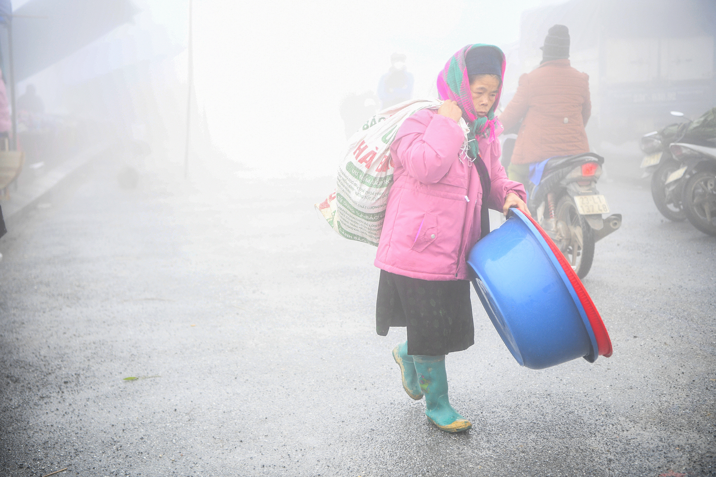 |
Cold air causes severe cold in the Northern region. Photo: Giang Huy |
Cold air causes severe cold in the Northern region. Photo: Giang Huy
The cold air will generate strong winds of level 2-3 inland and level 3-4 along coastal areas. At sea, from early tomorrow, the Gulf of Tonkin will experience strong northeast winds of level 6, gusting level 7-8, with waves reaching 2-3 m. The Northern East Sea, including the Hoang Sa area, will see winds of level 6-7, gusting level 8-9, and waves 3-5 m high.
Areas from Quang Tri to Khanh Hoa and the central East Sea will have winds of level 6, gusting level 7-8, and waves 3-5 m high. The sea area from Lam Dong to Ca Mau and the western Southern East Sea, including the western Truong Sa area, will experience winds of level 6, sometimes level 7, gusting level 8-9, with waves 4-6 m high.
Additionally, the cold air will cause showers and thunderstorms in provinces from Ha Tinh to Da Nang, and the eastern parts of provinces from Quang Ngai to Gia Lai. High mountainous areas of the Northern region should prepare for frost and hoarfrost.
The meteorological agency warns that severe cold, frost, and hoarfrost could impact livestock, poultry, and crops. Local heavy rainfall poses risks of flooding in low-lying areas, flash floods in small rivers and streams, landslides on slopes, and urban or industrial flooding.
On 1/1, temperatures in the Northern region were generally 15-18 degrees C, with some areas below 13 degrees C; the mountainous Northeast region recorded 12-15 degrees C. Drizzle contributed to the colder feel. This cold spell has persisted since early january due to continuous cold air reinforcement.
Gia Chinh
>>> See more weather information


