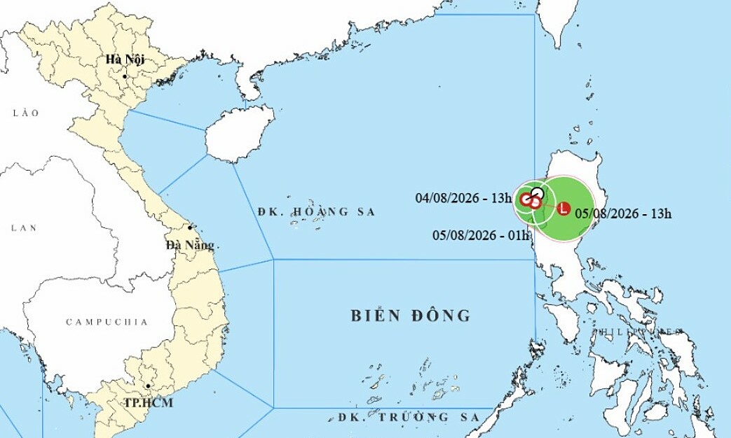
The National Center for Hydro-Meteorological Forecasting announced that at 7 am on 5/8, the typhoon's eye was located over the southeastern part of the northern East Sea. It had maximum sustained winds of 74 km/h, reaching level 8, with gusts to level 10, and was moving eastward at 3-5 km/h.
By the morning of 6/8, as it approached northwest Luzon Island (Philippines), the typhoon was forecast to weaken into a tropical depression with winds of level 6-7, gusting to level 9, due to friction with the island. It would then move east-northeast at 5-10 km/h.
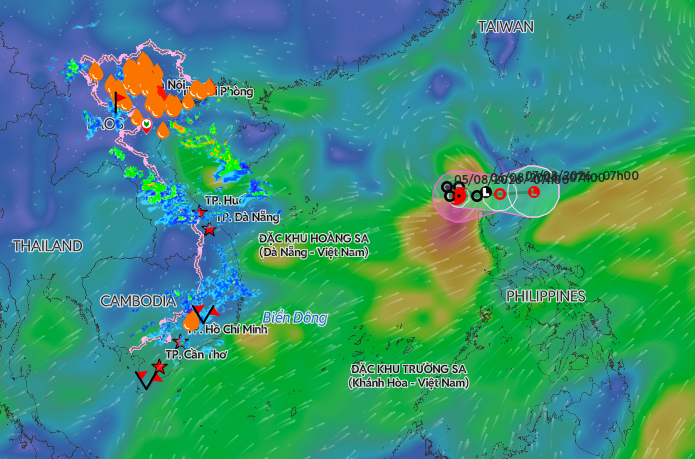 |
Position of Typhoon Kujira on the morning of 5/8. *Photo: Disaster Monitoring System*
By the morning of 7/8, the tropical depression would continue moving east-northeast, further weakening into a low pressure area over the northeastern part of Luzon Island.
On 5/8, the southeastern part of the northern East Sea would experience stormy rain and strong winds of level 6-7, gusting to level 9. Areas near the typhoon's eye would have winds of level 8, gusting to level 10, with sea waves 2-4 m high.
International meteorological agencies, including Japan and Hong Kong, confirmed that the typhoon would weaken into a tropical depression within the next 24 hours and would not affect mainland Vietnam.
The National Steering Committee for Civil Defense issued an official dispatch urging the People's Committees of coastal provinces and cities from Quang Ninh to An Giang, along with relevant ministries and sectors, to closely monitor the typhoon's developments. They were also asked to manage vessels, account for all vehicles operating at sea, and issue timely warnings to ensure proactive sheltering.
So far this year, the East Sea has experienced three typhoons. Typhoon Maysak, which occurred in early July, caused no loss of life but damaged 96 roofs, and 13 boats and rafts either drifted away or sank. It also affected about 1,100 hectares of aquaculture, with total estimated damage of about 20 billion VND.
According to the meteorological agency's forecast, the number of typhoons and tropical depressions in the East Sea from now until the end of the storm season may be similar to or lower than the multi-year average, which typically sees 11-13 storms. However, these storms are likely to be strong, with complex trajectories and unpredictable developments.
Gia Chinh