On the afternoon of 24/7, the National Civil Defense Steering Committee held its first meeting. Deputy Minister of Agriculture and Rural Development Nguyen Hoang Hiep said that from August to October, ENSO (El Niño-Southern Oscillation) is 70-90% likely to remain neutral and 50-60% likely to maintain this state until 1/2026.
The Ministry of Agriculture and Rural Development predicts that the peak typhoon season, from now until October, will see 6-8 typhoons and tropical depressions in the South China Sea, with 2-3 directly impacting Vietnam. From November to December, an additional 2-3 typhoons or tropical depressions are expected, with 1-2 making landfall.
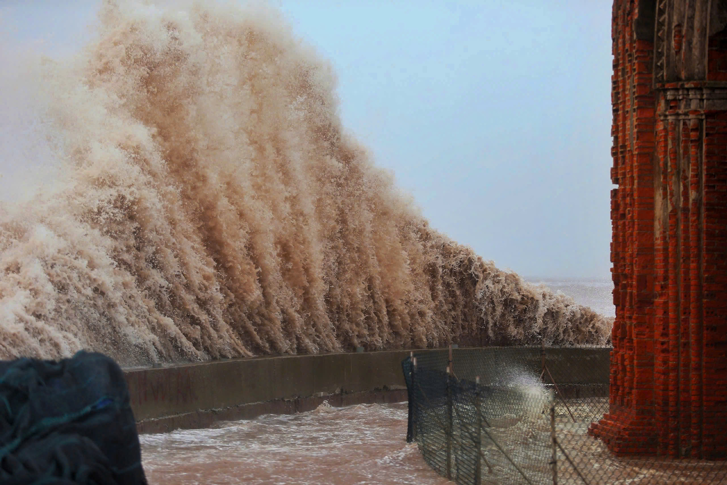 |
Typhoon Wipha makes landfall in Ninh Binh on 23/7. Photo: Pham Chieu |
Typhoon Wipha makes landfall in Ninh Binh on 23/7. Photo: Pham Chieu
The ministry also assesses that from the latter half of July to September, northern Vietnam, north-central Vietnam, the Central Highlands, and southern Vietnam are likely to experience periods of prolonged heavy rain. Central Vietnam should be especially aware of the possibility of unusual heavy rain during the seasonal transition, particularly off-season or localized downpours. The central Vietnam rainy season will concentrate in October, November, and the first half of December, coinciding with the peak activity of typhoons, tropical depressions, and adverse weather systems.
Flood levels on major rivers in northern Vietnam are predicted to reach warning levels one and two; smaller rivers and upstream areas may reach warning levels two and three. In north-central Vietnam (Thanh Hoa - Hue City), rivers like the Ma (Thanh Hoa) and Ca (Nghe An, Ha Tinh) are likely to reach warning levels one and two, with some possibly exceeding warning level two.
The Quang Tri - Da Nang region, as well as rivers in Quang Ngai, Gia Lai, Khanh Hoa, and Lam Dong provinces, will see flood levels rise to warning levels two and three, with some areas exceeding warning level three.
In the Mekong River basin, this year's flood peak is forecast to be around the average of previous years. Peak floods at Tan Chau and Chau Doc (upstream of the Mekong Delta) are expected to reach warning level one, while downstream stations could reach levels two and three, even exceeding level three in some locations.
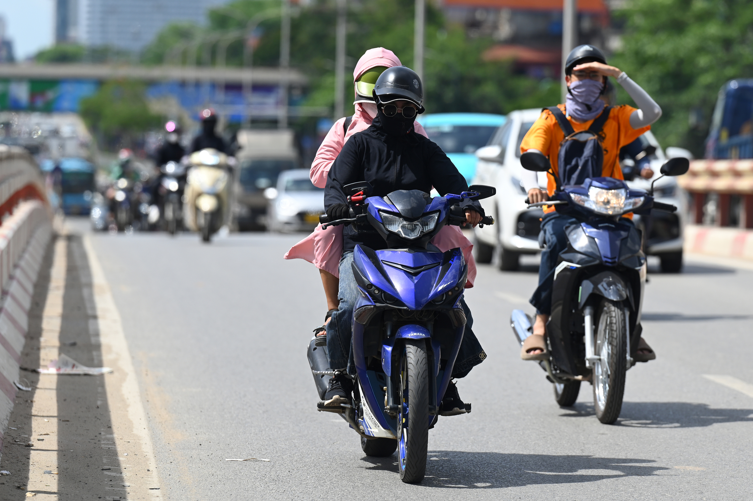 |
Heatwave in Hanoi, 6/2025. Photo: Giang Huy |
Heatwave in Hanoi, 6/2025. Photo: Giang Huy
Regarding heat waves, the meteorological agency assesses that they will continue in central Vietnam from the latter half of July to August. However, the intensity is expected to gradually decrease from now until September.
Cold air will begin to affect the region from September to October, increasing in intensity and frequency from November. Widespread severe cold and frost in northern Vietnam are likely to occur similarly to the average of previous years for the same period (from the latter half of December).
Unusual heavy rain and floods in the first half of 2025
In the early months of 2025, natural disasters in Vietnam were unusually intense and more extreme than average. There were two tropical depressions and three typhoons in the South China Sea; seven widespread heat waves in northern, central, and southeastern Vietnam. There were also two early and unusual floods; 14 flash floods and landslides in 18 midland and mountainous provinces in the north, central, and Central Highlands.
Extreme rainfall occurred in May. Out of 103 monitoring stations, 55 recorded over 100 mm of rain, 29 over 200 mm, 13 over 300 mm, and 7 over 400 mm. Notably, Ky Giang commune (Ha Tinh) recorded 601 mm of rain—the highest ever recorded in May and for the entire year so far. In Ky Hoa commune (Ha Tinh), rainfall in one hour reached 172.8 mm—a record high in the observation data series.
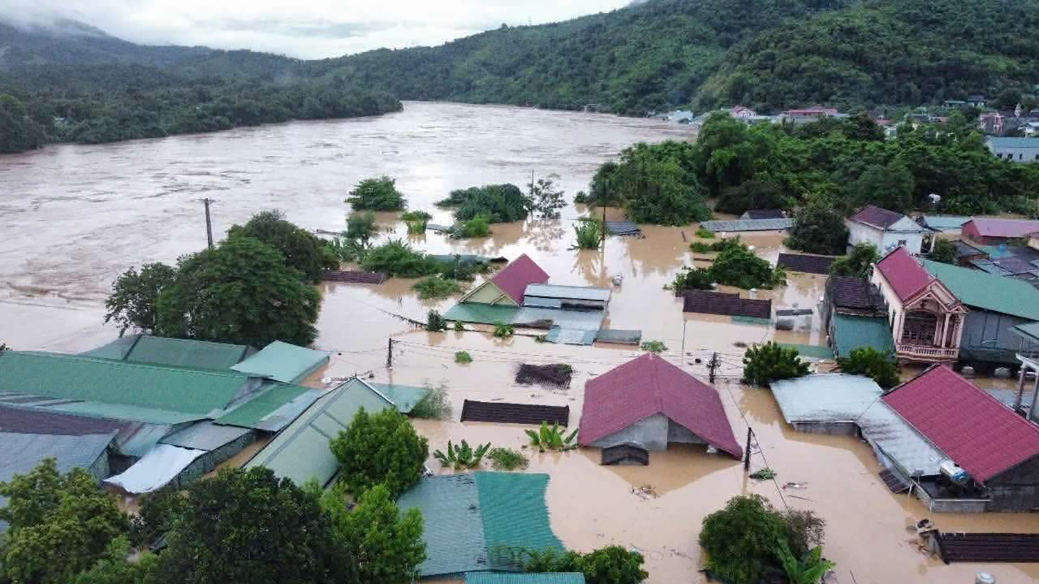 |
Flooding in Muong Xen, Nghe An. Photo: Duc Hung |
Flooding in Muong Xen, Nghe An. Photo: Duc Hung
In June, heavy rain in Viet Bac, centered in Bac Quang (Tuyen Quang), reached 631 mm in two days—an extremely rare value in the June data series. Typhoon Witup, though not making landfall, brought heavy rain to Ha Tinh - Da Nang with widespread rainfall of 250-550 mm, exceeding 800 mm in many places. Bach Ma station (Hue City) recorded 1,203 mm in three days—the highest in June's history. The heavy rain caused flooding on the Kien Giang, Thach Han, and Bo rivers at their highest levels in 30 years.
The Thai Binh river system also experienced flooding from 20-23/6. The Gia Bay station on the Cau River exceeded the historical peak flood level for the same period in June.
On the afternoon of 19/7, a supercell thunderstorm struck several northern provinces, causing severe consequences, including the capsizing of a tourist boat in Ha Long Bay, resulting in 37 deaths and two missing persons.
Typhoon Wipha, making landfall between Hung Yen and Thanh Hoa with wind speeds of level 8-9, caused heavy rain in Thanh Hoa and Nghe An provinces. In Nghe An, the water level at Muong Xen station reached 145.8 m at 1 a.m. on 23/7, 0.4 m above the historical flood level and 3.89 m above warning level three. At Thach Giam station, the flood peaked at 76.13 m at 8 a.m. on 23/7, 4.31 m above the historical flood level and 7.13 m above warning level three.
The Ministry of Agriculture and Rural Development reports that natural disasters have caused 114 deaths and 553 billion VND in economic losses since the beginning of the year.
From 24/7, the National Steering Committee for Natural Disaster Prevention and Control and the National Committee for Incident Response and Search and Rescue merged to form the National Civil Defense Steering Committee. The head of the committee is Prime Minister Pham Minh Chinh, and the permanent deputy head is Deputy Prime Minister Tran Hong Ha. Specific responsibilities are being finalized by relevant units.
Gia Chinh