"If the average subsidence rate is 2 cm per year, the ground level could be about one meter lower than it is now after 50 years. At that point, would we have to build two dikes along the Saigon River?", Associate Professor, Doctor Nguyen Phu Quynh, Vice Director of the Southern Institute of Water Resources Science, said at a workshop on flood control, drainage, and urban wastewater treatment in Ho Chi Minh City (HCMC) on the afternoon of 15/9.
According to Nguyen Phu Quynh, numerous studies indicate that subsidence in certain areas of HCMC remains complex. The rate of subsidence does not necessarily remain constant over the years, as the ground may gradually compact, altering the degree of sinking. However, the city must conduct specific research and forecast risks to proactively develop response scenarios, as subsidence is a primary cause of increased flooding.
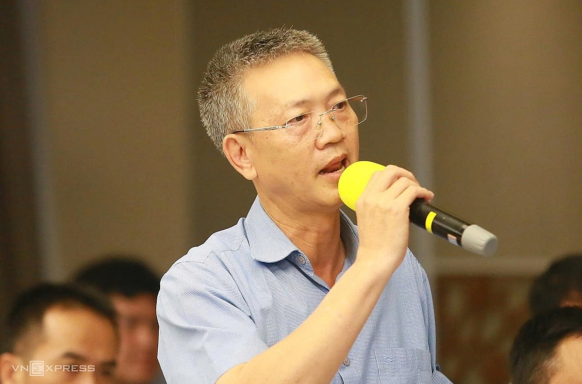 |
Associate Professor, Doctor Nguyen Phu Quynh, Vice Director of the Southern Institute of Water Resources Science, speaking at the workshop. *Photo: Giang Anh* |
Hoang Quang Huy, an expert from the Netherlands-based Haskoning Engineering Consulting Company specializing in flood risk management, also stated that subsidence in HCMC is a serious issue. He cited the Thao Dien area as an example: 20 years ago, it rarely flooded. However, in recent years, flooding occurs frequently during heavy rain or high tides, indicating that the ground elevation has changed due to subsidence. This situation necessitates new control measures.
The subsidence in HCMC has been previously warned about by many scientists and research groups. From 2006 to 2020, the subsidence rate in the city was recorded at about 2-5 cm per year, with some areas having weak geological foundations or concentrated commercial structures experiencing subsidence of 7-8 cm annually. The main reason is that the city lies on weak ground, particularly young Holocene sediments prone to compaction. Groundwater extraction, rapid urbanization, and the load from construction are also considered factors contributing to increased subsidence.
In addition to subsidence, Associate Professor, Doctor Nguyen Phu Quynh emphasized that HCMC needs to forecast sea-level rise for each phase. This is crucial baseline data for the city to calculate options within a 100-year integrated planning vision and proactively select flood response solutions. According to him, fundamental solutions require a simultaneous combination of three major factors: slowing runoff, storing water, and increasing drainage capacity during heavy rain and high tides.
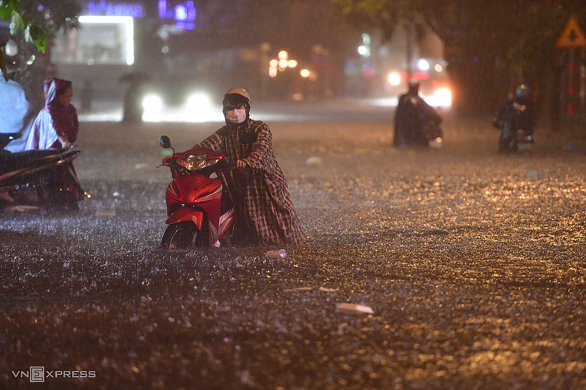 |
Water nearly level with motorcycle seats on Quoc Huong Street in the Thao Dien area (formerly Thu Duc City), evening of 10/9. *Photo: Thanh Tung* |
HCMC currently records approximately 159 flood points following its administrative boundary expansion, including 76 points in the old city area, 52 points in the former Binh Duong area, and 31 points in the former Ba Ria - Vung Tau area. Within the old city area, many flood points have persisted for years during heavy rain or high tides, such as Thao Dien, Thu Duc market, and several southern routes like Tran Xuan Soan and Le Van Luong.
At the workshop, Raissa Marteaux, Consul General of the Kingdom of the Netherlands in HCMC, suggested that in this new context, the city requires a comprehensive strategy for flood control and wastewater treatment. According to her, the issue extends beyond merely building infrastructure; it also involves efficient water use and management.
"Infrastructure is only part of the answer. What is important is the mindset of creating flow, dedicating more space for canals, ditches, and rivers, and finding ways to store water", she stated, adding that to enhance flood prevention capabilities, the city government needs greater participation and support from urban planners and businesses.
According to Le Ngoc Linh, Deputy Director of the Ho Chi Minh City Department of Construction, after the administrative boundary expansion, the city's total area is approximately 6,778 km2, with significant differences in topography and hydrological regimes across regions. HCMC is also increasingly affected by extreme weather, high tides, sea-level rise, and subsidence. Meanwhile, some old plans are no longer suitable, and the systems of canals, drainage pipes, and pump stations are not synchronized, leading to ongoing limitations in flood control.
To improve this situation, during phase 2026-2030, the city plans to complete 87 projects with a total capital of approximately 140,000 billion VND, aiming to fundamentally resolve 50 flood locations. Flood control efforts will also shift from addressing individual points to comprehensive basin management, while also considering factors such as extreme rainfall, high tides, sea-level rise, subsidence, urban planning, and water storage space.
Additionally, the leadership of the Department of Construction stated that the city intends to combine traditional drainage infrastructure with green infrastructure, regulating lakes, water storage spaces, and nature-based solutions. The ideas presented at the workshop will be synthesized and adopted by the Department to finalize flood control solutions throughout the area.
Giang Anh