The Hanoi Department of Construction recently submitted a plan to the Hanoi People's Committee for the renovation and expansion of Ring Road 2, encompassing both its elevated and lower sections, specifically the segment from Nga Tu So to Cau Giay. The estimated total investment for the project is over 21,300 billion VND, with land clearance costs accounting for a significant portion at nearly 17,000 billion VND. The remaining funds are allocated for construction and related items. Implementation is slated from now until 2028.
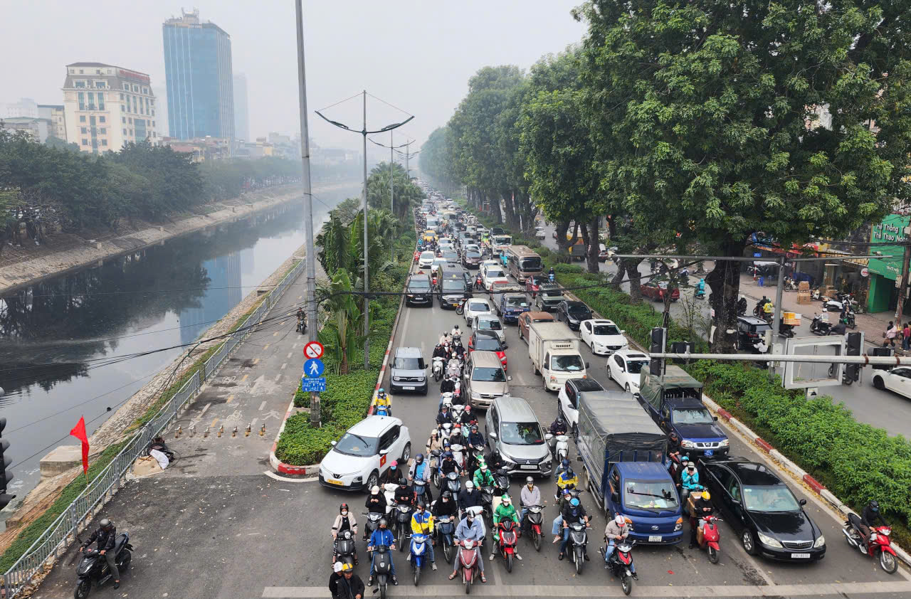 |
Lang Street near the Lang Ha - Le Van Luong overpass. Photo: Hoang Phong |
Lang Street, currently just 10,5 m wide per side, faces severe congestion. Traffic volume reaches 8,000 vehicles per hour, far exceeding its maximum capacity of 3,000 vehicles per hour, leading to frequent peak hour bottlenecks. The project is crucial for completing the inner-city ring road network, easing traffic pressure at the Nga Tu So intersection, and enhancing the efficiency of the already completed elevated Ring Road 2 section from Vinh Tuy to Nga Tu So.
In response to city leadership directives, the Department of Construction, in collaboration with relevant agencies, studied proposed solutions. hai main options emerged: expanding the lower road and constructing an elevated bridge, or building a large-diameter submerged tunnel for road traffic combined with surface water collection to combat flooding in the area.
The elevated bridge option proposes aligning the bridge's centerline with the planned centerline of the lower road. This design features a cross-section of 53,5 m for the lower road and 19 m for the elevated section. This approach offers several advantages, including consistency with the Vinh Tuy - Nga Tu So section's planned cross-section, convenient on-ramps and off-ramps at intersections, and minimal disruption to traffic during construction.
The alternative involved a large-diameter submerged tunnel, ranging from 14,5 m to 15,2 m, designed for both road traffic and flood prevention through surface water collection. This plan included open and closed tunnel branches connecting at the Nga Tu So intersection. However, the Department of Construction identified several drawbacks with the tunnel option: it would be affected by the pillars of the Cat Linh - Ha Dong railway, lacked sufficient technical space for a 4-lane tunnel, and posed potential risks to Mieu Pagoda and nearby residential buildings. Furthermore, intersections with urban railway line 5 and existing elevation constraints would limit the tunnel's length, leading to low investment efficiency.
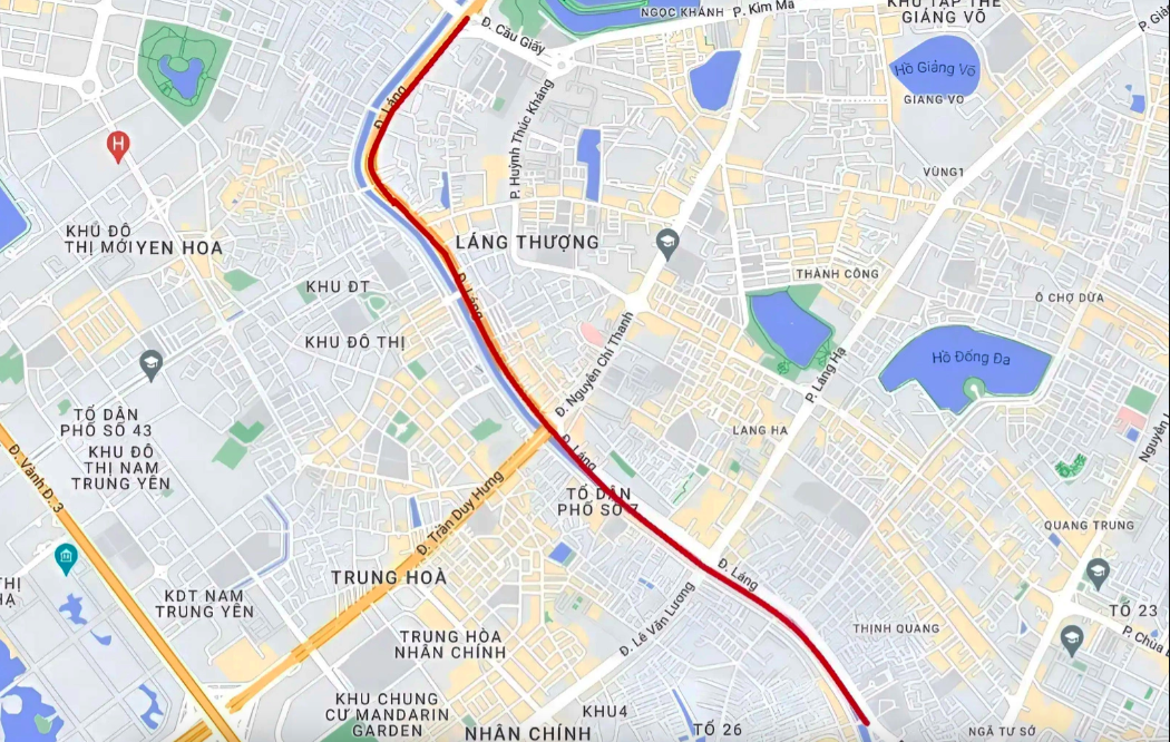 |
Location and route of the Lang Street expansion. Photo: Gmap |
Based on these analyses, the Department of Construction recommends the elevated bridge option. Initially, this project would be funded through public investment from the city budget to accelerate progress. Subsequently, a transition to a public-private partnership (PPP) model could be explored to diversify funding sources.
Ring Road 2 is Hanoi's 43,6 km closed inner-city traffic route, connecting various key locations: Vinh Tuy, Minh Khai, Dai La, Nga Tu Vong, Truong Chinh Street, Nga Tu So, Lang Street, Cau Giay, Buoi, Nhat Tan, Vinh Ngoc, Dong Hoi, Gia Lam underpass, Hanel Industrial Park, and back to Vinh Tuy. The ring road includes hai Red River overpasses, Vinh Tuy and Nhat Tan, and mot Duong River overpass, Dong Tru. Currently, only the 4 km section from Nga Tu So to Cau Giay, which coincides with Lang Street, remains unexpanded and without an elevated road.
Vo Hai