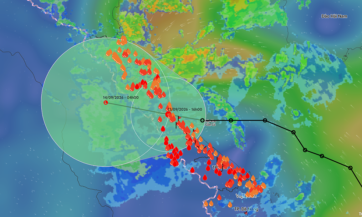
Influenced by the remnants of a tropical depression and a tropical convergence zone, the area from southern Nghe An to northern Quang Tri experienced widespread rainfall of 60-100 mm from the evening of 13/9 to the morning of 14/9, with local amounts exceeding 100 mm. Notable high rainfall records included Hoa Thanh in Quang Tri with 225 mm, and Ky Thuong in Ha Tinh with 184 mm.
The National Center for Hydro-Meteorological Forecasting predicts that from the morning of 14/9 to the night of 15/9, the southern Red River Delta and the region from Thanh Hoa to northern Ha Tinh will see 150-300 mm of rain, with local areas exceeding 450 mm. Southern Son La, Phu Tho, and the rest of Ha Tinh are forecast to receive 100-180 mm of rain, with some places seeing over 250 mm.
This heavy rainfall could trigger a flood event on rivers from Thanh Hoa to Hue City, lasting until 16/9. The Ngan Sau and Ngan Pho Rivers in Ha Tinh have the potential to reach alert levels two and three. The Thach Han River continues to recede but remains at alert levels one and two. Other rivers are generally at alert levels one and two, with some exceeding alert level two.
Nearly 200 communes and wards across Thanh Hoa, Nghe An, Ha Tinh, Quang Tri, and Hue City have been warned of flash flood and landslide risks. These risks are primarily in mountainous areas, on slopes, and where heavy rain persists. The risk level in western Thanh Hoa, Nghe An, Ha Tinh, and Quang Tri is assessed as high to very high.
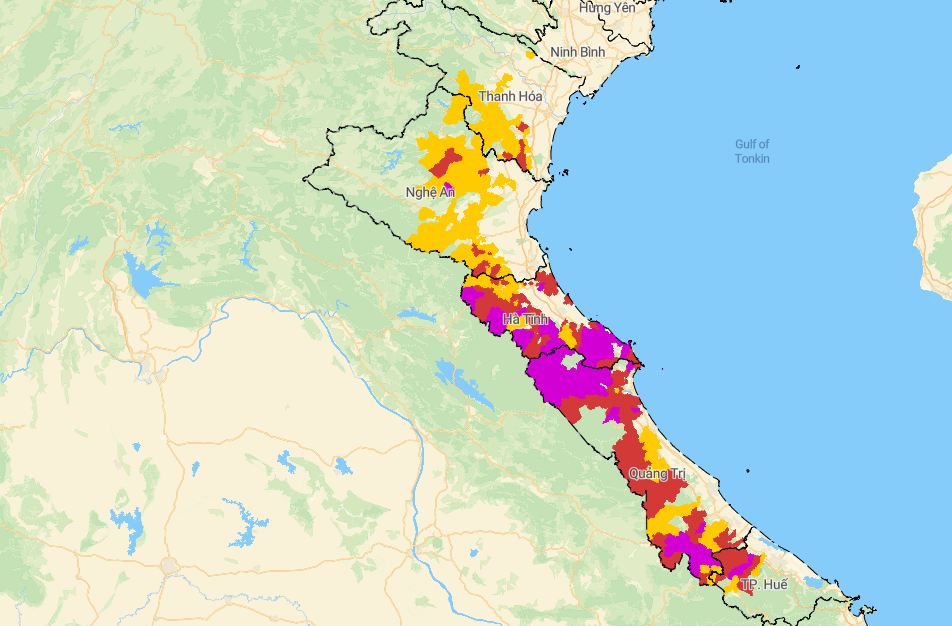 |
Areas at risk of landslides and flash floods (purple indicates very high risk). Photo: National Bureau of Hydro-Meteorology
Over 700 households evacuated
According to the Department of Dike Management and Disaster Prevention and Control, as of 6h on 14/9, the floods damaged nine houses, including five in Quang Tri and four in Hue. In Quang Tri, 591 houses were flooded. Local authorities have evacuated 712 households to safety, comprising: 663 households in Quang Tri, five in Hue, and 44 in Da Nang.
Floodwaters submerged 19 sections of national highways and provincial roads, causing traffic congestion. Affected routes include National Highway 9B, 15D, Provincial Road 588A, 586, 587, 571 in Quang Tri, and Road 17B in Hue.
Additionally, 55 spillway bridges, culverts, and inter-village roads were flooded 0,2-0,8 m deep, with some areas over one meter, causing local isolation. Of these, Quang Tri accounted for 43 locations and Hue for 12. As of the afternoon of 13/9, water in Hue City was receding, but some areas in Phong Dien and Phong Dinh remained flooded.
Around 14h on 13/9, rising, swift floodwaters swept three barges downstream, stranding them at My Chanh railway bridge, Km651+084 on the North-South line, in Nam Hai Lang commune, Quang Tri. This incident threatened the safety of railway infrastructure, National Highway 1, and inland waterway traffic.
Gia Chinh